
What is recorded here
Birchgrove, Eildon is an enclosure in Scottish Borders, Scotland.
Places near here
Photo credits
- James Denham, Wikimedia Commons · CC BY-SA 2.0
- Jim Barton, Wikimedia Commons · CC BY-SA 2.0
- Walter Baxter, Wikimedia Commons · CC BY-SA 2.0
- Ian S, Wikimedia Commons · CC BY-SA 2.0
- Iain Lees, Wikimedia Commons · CC BY-SA 2.0
- Richard Webb, Wikimedia Commons · CC BY-SA 2.0
- Gordon Hatton, Wikimedia Commons · CC BY-SA 2.0
- Maker shown on the Wikimedia Commons file page · CC BY-SA 2.0 de
 EildonCairn, Flat Axehead (bronze)(bronze Age), Hoard (bronze Age) (possible), Spearhead (bronze)(bronze Age) · 391 yd
 Newtown St BoswellsTrack(s) (possible) · 397 yd
 Newtown St Boswells, Roxburgh County OfficesCounty Building (20th Century) · 714 yd
 War MemorialMemorial · 721 yd
 Newtown St Boswells, Auction MartLivestock Market (19th Century) - (20th Century) · 795 yd
 Whinnyfield PlantationForest · 1115 yd
 Scottish Borders Donkey SanctuaryHeritage attraction · 1629 yd
 Wallace StatueHeritage attraction · 1712 yd
 Old WoodForest · 1.1 mi
.jpg/250px-Bemersyde_House_(geograph_5415330).jpg "Photo: Walter Baxter, Wikimedia Commons · CC BY-SA 2.0") Bemersyde HouseArmorial Panel (16th Century), Country House (18th Century), Tower House (medieval), War Memorial (20th Century) · 1.1 mi
Bemersyde HouseArmorial Panel (16th Century), Country House (18th Century), Tower House (medieval), War Memorial (20th Century) · 1.1 mi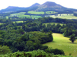 Trimontium - The Place of the Three (Eildon) HillsVisitor information · 1.3 mi
 Trimontium viewing platformViewpoint · 1.3 mi
More archaeology and monuments in Scottish Borders · All of Scottish Borders

What do you know about this place?Tap to add a comment or ask a question