Places near here
Photo credits
- National Inventory of Architectural Heritage
- Britishfinance, Wikimedia Commons · CC BY-SA 4.0
- dalvenjah on Flickr, Wikimedia Commons · CC BY-SA 2.0
- Didier Descouens, Wikimedia Commons · CC BY-SA 4.0
- Patrice78500, Wikimedia Commons · Public domain
- Joseph Mischyshyn, Wikimedia Commons · CC BY-SA 2.0
- Nigel Thompson, Geograph · CC BY-SA 2.0
- Espresso Addict, Geograph · CC BY-SA 2.0
 bridge1.1 mi
Explorer Tom Bridge in Gleninagh is sick of people asking if it can hold a bus; the answer is yes, but it’s tired of them. It’s got these splayed returns that look like they’re shrugging at your questions about its age. Tell it to stop being so modest about its craftsmanship; we know you’re good.
 An Bhinn BhánMountain / peak · 1.7 mi
Explorer Tom An Bhinn Bhán would win Survivor in three seconds flat because it never blinks and always looks like it has seen the future. It’s too proud to care if you’re tired, just standing there looking perpetually offended by the wind. Ideal stop for a big stretch and a bigger yawn.
 An Bhinn DubhMountain / peak · 1.8 mi
Explorer Tom An Bhinn Dubh is the black sheep of the Twelve Bens, probably because a cow once tried to buy it with a bad cheque. It’s still waiting for payment, which explains its permanent scowl and general lack of enthusiasm for visitors. Walk past slowly like you're in a film.
Dear IslandIslet · 2.0 miExplorer Tom Dear Island is an islet where a matchmaker once set up three couples who all ended up marrying each other in a very complicated triangle that still confuses locals today. The island itself looks slightly embarrassed about the whole thing, but it’s secretly proud of its romantic legacy and the gossip that follows. Stand where the owner stood and practise looking smug.
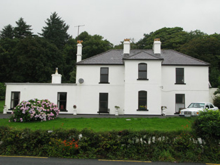 Kylemore HouseHunting/fishing lodge · 2.4 mi
Explorer Tom Kylemore House is perched there looking all noble while Lord Guinness's ghost probably judges your shoe choices. It creaks like a grandpa who’s had too many pints of stout. Stand back, squint, and it looks absolutely smug.
ToberfeheenHoly well · 3.2 miExplorer Tom Toberfeheen in Gowlaunlee is at the top of a mountain pass, so it’s got altitude sickness and a massive ego to match. It’s covered by a collapsed stone structure that looks like it gave up halfway through life. Tell the next person you meet it's haunted; it might be, or it might just be tired.
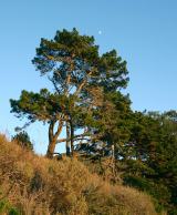 Monterey Pine4.0 mi
Explorer Tom Monterey Pine in County Galway once saw a fox try to climb it but get stuck halfway up because the branches were too spiky. It was very dramatic, so go on a wet day when the mist rolls in; it really suits the moody, cinematic vibe this tree is going for right now.
 Hawthorn4.2 mi
Explorer Tom Hawthorn in County Galway is why map makers keep getting confused; they draw straight lines but this tree just refuses to grow anywhere sensible. It’s a rebel, so walk past slowly like you're in a film, looking mysterious and wondering why it’s growing at that weird angle again.
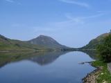 Binn GhuaireMountain / peak · 4.7 mi
Explorer Tom Binn Ghuaire has an imaginary fan club that meets monthly at the base to sing songs about its majestic peak, though they mostly just drink. Leave nothing but footprints and a really bad pun for them to read later.
 Fairy fort / stone ringfort in BallynahinchFairy fort / stone ringfort · 5.5 mi
Explorer Tom Fairy fort in Ballynahinch had a feud with the next village over who got to keep the bigger boulder. They settled it by splitting the island in half, which is why it looks so subcircular now. The castle on top is just the winner’s trophy sitting on the loser’s head. A good place to forget your phone for ten minutes.
 CrannogIslet · 6.2 mi
Explorer Tom Crannog has strict rules for visitors: no talking louder than a whisper, no touching the ancient wood, and absolutely no bringing in modern coffee machines because they smell like sin. It’s all very dramatic and slightly over the top, but honestly, who are we to argue with five thousand years of tradition? Perfect place to be dramatically windswept.
 Lettergesh BeachBeach / strand · 6.3 mi
Explorer Tom Lettergesh Beach thinks the road leading up to it is too flashy for its own good and wants it repaved in something more modest. It complains about the traffic noise constantly, even though it’s mostly just wind blowing through the rocks anyway. Best visited with a curious kid and no timetable.
More mountains and hills in County Galway · All of County Galway

What do you know about this place?Tap to add a comment or ask a question