
What is recorded here
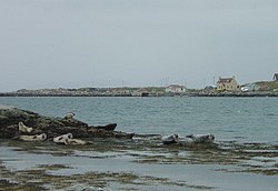
Berneray, Berneray Harbour is a harbour in Na h-Eileanan Siar, Scotland.
From the Historic Environment Scotland record 277827
The historic-place record does not grant public access. Check current conditions and ownership before entering land or a building.
Places near here
Photo credits
- Richard Law, Wikimedia Commons · CC BY-SA 2.0
- Tom Richardson, Wikimedia Commons · CC BY-SA 2.0
- Colin Smith, Wikimedia Commons · CC BY-SA 2.0
- Julian Paren, Wikimedia Commons · CC BY-SA 2.0
- Richard Webb, Wikimedia Commons · CC BY-SA 2.0
- Stephen Darlington, Wikimedia Commons · CC BY-SA 2.0
- Eilidh Carr, Wikimedia Commons · CC BY-SA 2.0
- Hugh Venables, Wikimedia Commons · CC BY-SA 2.0
- Frances Watts, Wikimedia Commons · CC BY-SA 2.0
 Berneray harbour at BorveHeritage place · 73 yd
 Rubha Mhanais, BernerayEnclosure(s) · 251 yd
 Rubha MhanaisHeadland · 269 ydRubha Mhanais, BernerayBuilding · 297 yd
 Loch a' BhàighBay · 404 yd
 BernerayWell · 654 yd
 Cnoc BhuirghMountain / peak · 742 yd
 Beinn a'ChlaidhMountain / peak · 1283 yd
 BeàrnaraighIsland · 1315 yd
 Growing beachBeach · 1326 yd
 Beach on BernerayBeach · 1388 yd
 Causeway Opening Commemoration StoneMemorial · 1537 yd
More historic places in Na h-Eileanan Siar · All of Na h-Eileanan Siar
What do you know about this place?