
What is recorded here
Ben Horn is a mountain or peak in Highland, Scotland.
From OpenStreetMap (© OpenStreetMap contributors) n2717182224
Places near here
Picture notes
- Stanley Howe, Wikimedia Commons · CC BY-SA 2.0
- Dave Thompson, Wikimedia Commons · CC BY-SA 2.0
- John Lucas, Wikimedia Commons · CC BY-SA 2.0
- Andrew Tryon, Wikimedia Commons · CC BY-SA 2.0
- Trevor Littlewood, Wikimedia Commons · CC BY-SA 2.0
- Alasdair MacDonald, Wikimedia Commons · CC BY-SA 2.0
- Computer-made picture. It does not show this playground.
- JThomas, Wikimedia Commons · CC BY-SA 2.0
- Andrew Abbott, Wikimedia Commons · CC BY-SA 2.0
- Computer-made picture. It does not show this garden.
 Dunrobin GlenBuilding, Corn Drying Kiln · 1.2 mi
 Bridge of HornCorn Drying Kiln, Enclosure(s), House, Hut Circle (prehistoric) (possible), Rig and Furrow (medieval) - (post Medieval) · 1.2 mi
 Kilbraur Wind FarmCairnfield (prehistoric), Plant Remains (prehistoric), Worked Object (prehistoric) · 1.6 mi
 KilbraurRig and Furrow (medieval) - (post Medieval), Township · 2.4 mi
 BackiesCave · 2.7 mi
 Beinn LunndaidhMountain / peak · 2.9 mi
 Ben BhraggieMountain / peak · 3.3 mi
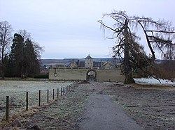 Battle of Alltan-BeathBattle · 3.5 mi
 Children's playground4.0 miComputer-made picture. It does not show this playground.
 Colin's BridgeMemorial · 4.0 mi
 Monument to the 2nd Duke of SutherlandMemorial · 4.0 mi
 Golspie Community GardenGarden · 4.2 miComputer-made picture. It does not show this garden.
More mountains and hills in Highland · All of Highland

What do you know about this place?Tap to add a comment or ask a question