What is recorded here
Bawn in Pallas More is a rock-cut moat and collapsed castle courtyard on a Tipperary ridge, held by Donogh O Bryen in 1640 and still named as a ruinous court in 1654. The narrow ditch, broad causeway and broken walls mark a small power centre perched above the upland, where judgment, passage and protection all depended on the edge of the rock.
Situated on a natural ridge of rock outcrop in an upland area with extensive views. Described in the Civil Survey (1654-6) as a 'ruinous castle with the priviledge of a court leete and courte' (Simington 1934, vol. 2, 141-2). Donogh O Bryen is listed as proprietor in 1640 (ibid.). The OS Letters describe a water-filled moat with the wall-footings of castle on top of rock outcrop (O'Flanagan 1930, vol. 3, 14). The present remains consist of the collapsed masonry of a castle (TN020-024001-) which was enclosed at its base on the W side by a rock-cut moat (Wth 3.5m; ext. D 1.4m) with causewayed entrance (Wth 4m) at WSW. The rock cut-moat forms the enclosing defensive element of the bawn or courtyard of Pallas Castle.
The above description is derived from 'The Archaeological Inventory of County Tipperary. Vol. 1 - North Tipperary' compiled by Jean Farrelly and Caimin O'Brien (Dublin: Stationery Office, 2002). In certain instances the entries have been revised and updated in the light of recent research.
Date of upload/revision: 16 January 2012
Built during the 16th or early 17th century, Bawn in Pallas More was held by a local Gaelic lord or Anglo-Irish family, as suggested by its judicial privileges noted in the Civil Survey. It is remembered for its strategic location and the presence of a court leet, indicating its role in local governance and administration.
The monument record does not grant public access. Check the route and ask the landowner before entering private land.
- What survives
- Recorded monument
Places near here
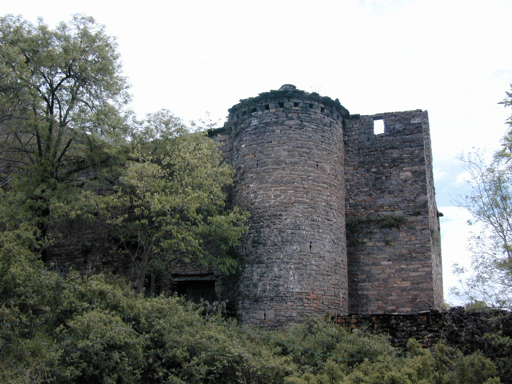 (Site of) Pallas CastleCastle, Anglo-Norman masonry castle · 19 yd
 Pallas Church (in Ruins)Church · 667 yd
 LisdromoreFairy fort / earthen ringfort · 1077 yd
 Knockshane RathFairy fort / earthen ringfort · 1097 yd
 CastleCastle, unclassified · 1.1 mi
 Newtown Millmill (water) · 1.2 mi
 Giant's GraveArchaeological place · 1.4 mi
 Corbally HillMountain / peak · 1.9 mi
 Blessed WellNature reserve · 2.1 mi
 Coum HillMountain / peak · 2.3 mi
 Youghal BayBay · 3.3 mi
 Saint Patrick's RockNamed rock · 3.4 mi