What is recorded here
On a S-facing slope, c. 50m N of the River Tar, in gently undulating pasture. Indicated as a 'Castle' on the 1st (1840) ed. OS 6-inch map and as a 'Castle (site of)' on the 1904-05 edition. The monument is referred to in the Civil Survey (1654-6) as 'an old castle within an old Bawne' (Simington 1931, vol. 1, 334). There is no visible remains of the bawn or castle (TS088-029001-) at ground level.
From the National Monuments Service (Archaeological Survey of Ireland) record TS088-029002
The monument record does not grant public access. Check the route and ask the landowner before entering private land.
- What survives
- Recorded monument
Places near here
 Tar BridgeBridge · 1001 yd
 Goats BridgeBridge · 1.0 mi
 Liam Lynch MonumentMonument · 1.6 mi
_-_geograph.org.uk_-_1393369.jpg/250px-Castles_of_Munster_-_Ardfinnan,_Tipperary_(2)_-_geograph.org.uk_-_1393369.jpg "Photo: Mike Searle, Wikimedia Commons · CC BY-SA 2.0") Ardfinnan CastleCastle · 2.9 mi
Ardfinnan CastleCastle · 2.9 mi KnockmealMountain / peak · 3.3 mi
 KnocknagnauvMountain / peak · 3.5 mi
 The VeeViewpoint · 4.1 mi
 Ballindoney Castle (in ruins)Castle, tower house · 4.4 mi
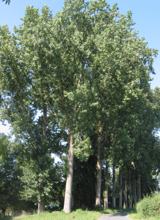 Hybrid Black Poplar4.5 mi
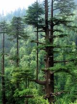 Deodar Cedar4.8 mi
 Crusader's GraveHeritage attraction · 6.6 mi
 Ballysaggartmore TowersHeritage attraction · 9.9 mi
Pictures: National Inventory of Architectural Heritage; Alexander Redfern, Wikimedia Commons · CC BY-SA 4.0; Mike Searle, Wikimedia Commons · CC BY-SA 2.0; Colin Park, Geograph · CC BY-SA 2.0; Hywel Williams, Geograph · CC BY-SA 2.0; Rasbak, Wikimedia Commons · CC BY-SA 3.0; Paul Evans from London, United Kingdom, Wikimedia Commons · CC BY 2.0; A.-K. D., Wikimedia Commons · CC BY-SA 4.0; Photo-raven, Wikimedia Commons · CC BY-SA 4.0
More castles and forts in County Tipperary · All of County Tipperary
What do you know about this place?