
Places near here
Photo credits
- Roger Cornfoot, Wikimedia Commons · CC BY-SA 2.0
- Rob Farrow, Wikimedia Commons · CC BY-SA 2.0
- Alan Rosevear, Wikimedia Commons · CC BY-SA 2.0
- Rod Allday, Wikimedia Commons · CC BY-SA 2.0
- Lewis Clarke, Wikimedia Commons · CC BY-SA 2.0
- Graham Horn, Wikimedia Commons · CC BY-SA 2.0
- Basher Eyre, Wikimedia Commons · CC BY-SA 2.0
- MDS, Wikimedia Commons · CC BY-SA 2.0
- Penny Mayes, Wikimedia Commons · CC BY-SA 2.0
- Jaggery, Wikimedia Commons · CC BY-SA 2.0
- N Chadwick, Wikimedia Commons · CC BY-SA 2.0
 SettlementArchaeological place · 792 yd
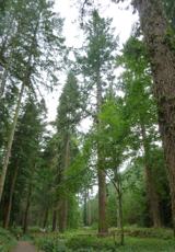 Tallest tree in EnglandDouglas Fir · 936 yd
 BonnitonListed building · 1056 yd
 Gallox BridgeScheduled monument · 1212 yd
 Rose CottageListed building · 1285 yd
 Dunster : WaterfallWaterfall · 1387 yd
 Sculpture in the forestPublic sculpture · 1467 yd
 Wooden sculpture outside tearooms in DunsterPublic sculpture · 1540 yd
 Seal woodForest or wood · 1.0 mi
 Dunster Castle and Yarn MarketCastle, fort or tower · 1.1 mi
 Exmoor National Park CentreVisitor information · 1.1 mi
 Black HillMountain / peak · 1.6 mi
More mountains and hills in Somerset · All of Somerset

What do you know about this place?Tap to add a comment or ask a question