What is recorded here
In rough pasture, 11m S of field boundary and 80m W of a stream that marks townland boundary with Feloree. A cluster of ring-barrows (LI023-226001-/009-) lie 280m to W and linear earthworks (LI024-179002-) lie 260 to NE. Not depicted on OS historical mapping. Identified by the Bruff aerial photographic survey in 1986 (Bruff 26; AP 4/3665) as a small circular cropmark of a possible ring-barrow. Cropmark is visible on OSi orthophotos taken 2005-2012, on Digital Globe taken 2011-2013 and on Google Earth orthoimage taken 28/06/2018.
See attached Google Earth orthoimages and Bruff survey image marked Bruff 26.
Compiled by: Fiona Rooney
Date of upload: 27 July 2020
A Neolithic ring-barrow; part of a broader burial landscape with associated ring-barrow clusters and linear earthworks, indicating significant ritual and funerary activity in the area.
The monument record does not grant public access. Check the route and ask the landowner before entering private land.
- What survives
- Recorded monument
Places near here
 BarrowBarrow, unclassified · 389 yd
 Field system in Ballyphilip (clanwilliam By.)Field system · 517 yd
 Aglishcormick Grave YardChurch · 1087 yd
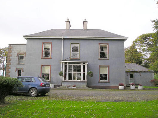 Cloverfield Housecountry house · 1.1 mi
 St. Patrick's WellSpring · 1.3 mi
 Kilteely HillMountain / peak · 1.7 mi
 KnockseefinMountain / peak · 2.3 mi
 Carrickittle RockCastle, unclassified · 2.4 mi
 CastleCastle, unclassified · 2.4 mi
 Flat cemetery in Knockainy WestFlat cemetery · 5.3 mi
 St Patrick's WellSpring · 7.9 mi
 Ballinvreena LoopVisitor information · 11 mi
Other information
Photo: Credit not shown in the picture search · Rights wording not checked; contact us if this picture should be removed