What is recorded here
Located at the bottom of a SE-facing slope in the flood-plain of the NE-SW River Bann with the stream c. 500m to the SE. Archaeological monitoring in advance of building new sewage works identified a ditch-barrow that was completely excavated (99E0450). It was a subcircular area (int. dim3.6-4.25m) with no internal features defined by a complete ditch (Wth 0.28m at NE to 0.9m at S; D 0.2-0.4m) with some stake-holes. Five cremated deposits representing seven individuals were in the ditch, underlain in some cases by burnt timbers, some of which had nails. Three of the deposits had grave goods, and up to fifty glass beads, a stone pendant, a scrap of bronze and a sherd of coarse pottery were recovered. C14 dates of 2090 +- 50 BP and 2190 +- 50 BP have been obtained. The pit (WX015-069----) is c. 20m to the S. (Ryan 2000b; 2012; Ryan and Henry 2000)
Compiled by: Michael Moore
Date of upload: 2 May, 2012
Amended: 21 October 2020
Ditch barrow, likely dating to the Early Bronze Age. Its location near the River Bann suggests a possible ritual or funerary function linked to water and landscape features of significance in prehistoric settlement and burial practices.
The monument record does not grant public access. Check the route and ask the landowner before entering private land.
- What survives
- Recorded monument
Places near here
 EnclosureEnclosure, large enclosure · 163 yd
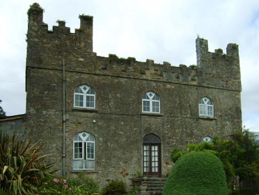 Killoggy Castlefarm house · 363 yd
 Enclosure in Ferns DemesneEnclosure · 364 yd
 St. Augustines Monastery (in ruins)Religious house, Augustinian canons · 433 yd
 Ferns Castle (in ruins)Castle, Anglo-Norman masonry castle · 970 yd
 Coolroe WoodForest · 1.2 mi
 CastleCastle, unclassified · 1.3 mi
 Kilbora WoodForest · 1.4 mi
 Milshoge RockMountain / peak · 3.7 mi
 Giants BedNamed rock · 3.7 mi
 Father Murphy CentreHeritage attraction · 4.2 mi
 Carrigroe HillMountain / peak · 4.2 mi