DDiscover AloneMapAbout

Barracks, County Dublin (DU019-040----)

Barracks
Computer-made picture that does not show BarracksNot a photo of this monument
Computer-made picture. It does not show this monument. · Report the wrong picture

What is recorded here

Pigeon House Fort / Barracks A 19th-century barracks on Pigeon House Road known as ‘Pigeon House Fort’ was recorded in 2025 in the ‘Our Shared Built Military Heritage: The online mapping, inventorying and recording of the Army Barracks of Ireland, 1690-1921' a project that was funded by the North South Research…

Read the whole record
Pigeon House Fort / Barracks A 19th-century barracks on Pigeon House Road known as ‘Pigeon House Fort’ was recorded in 2025 in the ‘Our Shared Built Military Heritage: The online mapping, inventorying and recording of the Army Barracks of Ireland, 1690-1921' a project that was funded by the North South Research Programme 2022-2024 and co-led by University College Dublin and The Open University' (Forbes and McGrath 2025). The barracks was described in the inventory of the ‘Army Barracks of Ireland - Our Shared Military Heritage, 1690-1921’ as follows; ‘Pigeon House Fort was one of a series of new barracks built in the early nineteenth century in Dublin in light of the rebellions of 1798 and 1803 as well as the ongoing Napoleonic Wars. It differed from the other new Dublin barracks at that time because it was designed primarily to protect British forces during a withdrawal in the event of a successful Irish rebellion. Although there was facilities for 72 soldiers and two officers in the area as early as 1801, construction of the Pigeon House Fort was not finished until 1814. Located on the Great South Wall equidistant from the lighthouse and Ringsend, it was in use throughout the majority of the nineteenth century. Alongside barrack quarters for 16 officers and 201 men, there were significant fortifications and armaments in case of attack and as a means to protect the adjacent Pidgeon House Harbour, which was intended as the point of evacuation if needed. The fort also had a hospital, magazine, arsenal, stores, and stables for 13 horses. It was sold to Dublin Corporation in 1897 and thereafter became part of the sewage and electrical infrastructure of Dublin City. It was briefly re-occupied by the National Army during the Irish Civil War. However, the garrison in 1922 consisted of only 21 men. Part of the original gateway and seawall are all that remains extant of the barracks'.

From the National Monuments Service (Archaeological Survey of Ireland) record DU019-040

The monument record does not grant public access. Check the route and ask the landowner before entering private land.

Official monument number
DU019-040----
What do you know about this place?Tap to add a comment or ask a question

What you write will be public.

Places near here

Photo credits
  • Gallags6, Wikimedia Commons
  • Doug Lee, Geograph · CC BY-SA 2.0
  • Sheila1988 / Wikimedia Commons, commons.wikimedia.org
  • National Inventory of Architectural Heritage
  • Maker not stated on source page, anakena.de
  • Tdr112, Wikimedia Commons · CC BY-SA 4.0
  • Eric Jones, Geograph · CC BY-SA 2.0
Irishtown Nature ParkPark · 587 yd

Explorer Tom Irishtown Nature Park is what happens when Dublin takes a pile of rubble, argues with it for a decade, and gives it a…

Sandymount StrandBeach / strand · 1388 yd

Explorer Tom Sandymount Strand has a ghost who is too lazy to haunt anyone because he cannot be bothered to lift his head off the…

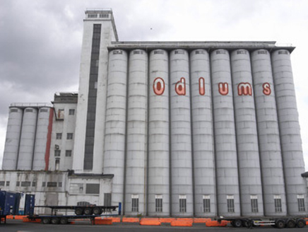
Clanna Gael GAA, FontenoyGAA ground · 1557 ydOdlum's MillsGranary · 1.2 mi

Explorer Tom Odlum's Mills on Alexandra Road is showing off its Art Deco grain silos. Built in 1935, it’s got that vertical emphasis…

electricity substation1.2 mi

Explorer Tom Electricity substation in County Dublin was once ruled by a goat who sat on the pedimented door surround and made all…

Easter Island MaoiStatue · 1.3 mi

Explorer Tom Easter Island Maoi in County Dublin can hear everything through the walls, including that neighbor’s terrible karaoke…

Grace DieuHouse · 1.3 mi

Explorer Tom Grace Dieu house on Clontarf Road is part of a terrace built by George Tickell around 1860. It has a bay window that…
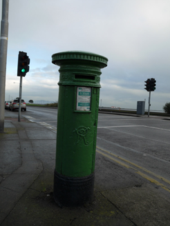
post box1.3 mi

Explorer Tom This post box in Greenlanes would post a story on social media about how it still has Queen Victoria’s initials on it…

Dublin Bus Clontarf GarageTram shed/depot · 1.3 mi

Explorer Tom The Dublin Bus Clontarf Garage was originally a tram shed back in 1874, so it’s basically the grandpa of public…

Church of St. John the BaptistChurch/chapel · 1.4 mi

Explorer Tom St. John the Baptist in Greenlanes has been around since before my great-great-grandmother was a twinkle in her eye. It…

milestone/milepost1.5 mi

Explorer Tom Milestone or milepost in North Bull is one of many distance markers set at thousand-foot intervals along the promenade…

Samuel Beckett BridgeVisitor information · 1.9 mi

Explorer Tom Samuel Beckett Bridge is doing its best to look like it knows what it's doing, which is a brave move for a piece of…

More archaeology and monuments in County Dublin · All of County Dublin

Add to this placeAdd a picture Add a detailed tip Add a story

Explore the map1,095,414 places to discover

Next place · or swipeIrishtown Nature Park