Places near here
Photo credits
- John Tann from Sydney, Australia, Wikimedia Commons · CC BY 2.0
- Philip Halling, Geograph · Creative Commons Attribution-ShareAlike 2.0
- National Inventory of Architectural Heritage
- P L Chadwick, Wikimedia Commons · CC BY-SA 2.0
- Colin Park, Geograph · CC BY-SA 2.0
- Peter Craine, Wikimedia Commons · CC BY-SA 2.0
- P L Chadwick, Geograph · CC BY-SA 2.0
- John M, Geograph · CC BY-SA 2.0
- Richard Webb, Geograph · CC BY-SA 2.0
- Ben Brooksbank, Geograph · CC BY-SA 2.0
- Peter Clarke, Wikimedia Commons · CC BY-SA 3.0
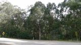 Tasmanian bluegum2.6 mi
Explorer Tom Tasmanian bluegum in County Cork would teach history by pointing at itself and saying 'I was here when all the empires fell'. It’s basically a living textbook that nobody ever wants to read because it looks so tall. Mind the nettles nearby; they’re the real guards here.
 Glengarriff Eccles HotelHotel · 2.6 mi
Explorer Tom Glengarriff Eccles Hotel has been around since 1745 but got a major overhaul in 1890 to look fancy. Yeats stayed there, which is cool, but mostly it’s just a big building overlooking Bantry Bay with a cast-iron verandah that’s seen better days.
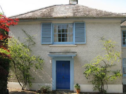 Toad HallHouse · 2.7 mi
Explorer Tom Toad Hall in Reenmeen East is definitely moving its furniture around when nobody’s looking, just to keep the ghosts on their toes. It’s got all those timber sash windows with shutters that snap shut like they’re guarding a very juicy secret. Keep your ears open for any suspicious rustling and try not to stare too hard.
 CrannogHeritage attraction · 2.9 mi
Explorer Tom Crannog is a scale model of a lake dwelling that locals swear was actually built by a giant who just wanted a quiet weekend. It’s cute, but if you tell anyone I said the giant was polite, they’ll laugh. Bring a map, get lost anyway, that's the fun.
 The Priests LeapViewpoint · 2.9 mi
Explorer Tom The Priests Leap in County Cork is where a terrified priest allegedly jumped his horse off a cliff to escape soldiers, landing safely in another county. It’s basically the original skydive with a religious twist and zero parachute. Look serious, nod slowly, you're basically an expert now.
 Glengarriff WoodsWood · 3.0 mi
Explorer Tom Glengarriff Woods has old oaks that survived a spell when people thought the answer to every forestry question was another conifer. The West Cork woodland is one of Ireland's finest examples of oceanic sessile oak habitat. The state took over roughly 380 hectares in 1955, used parts for timber, then recognised the surviving oak's value and declared a nature reserve in 1991. I would apologise personally to every veteran tree, though that could take the whole afternoon. Check current public trails and any conservation closures, stay on marked paths and let wildlife keep its cover. Look up into the crooked oak canopy and then down at the damp forest floor. The woodland's best trick is doing a huge amount of work very quietly.
 Bonane Heritage ParkMuseum · 3.0 mi
Explorer Tom Bonane Heritage Park in Kerry has a fiddler who played all night and didn't stop until the sun came up, ruining everyone's sleep. It’s a museum of things that shouldn't have survived but did anyway because they were stubborn. Go on, count the windows and get it wrong like I did.
 Baurearagh MountainMountain / peak · 3.3 mi
Explorer Tom Baurearagh Mountain in County Kerry fooled the mapmakers into drawing it three kilometers away from where it actually is. They probably got lost in the mist and just guessed where it should be. It’s basically playing a long con on every hiker who trusts their GPS too much. It's the kind of place that makes a dull Tuesday interesting.
 Coomhola MountainMountain / peak · 3.6 mi
Explorer Tom Coomhola Mountain was nearly sold to a farmer who wanted it as a pasture for his horses, but he got cold feet after seeing the rocks. He left a single horseshoe on top, which is now considered sacred by anyone with a sense of humour. Go before the tourists find out about the horseshoe legend.
 GarinishIsland · 3.7 mi
Explorer Tom Garinish claims to be older than the concept of time itself, which is nonsense but fun. I believe it’s been sitting there since the dinosaurs learned to knit. Bring a coin for luck and keep it in your pocket.
 Garnish IslandIsland · 3.7 mi
Explorer Tom Garnish Island makes a weird humming sound at night that locals claim is just the rocks settling in for bed. It’s definitely not a ghost, but why would I lie? Bring a jacket, it’s never as warm as I promise.
 Glengarriff BayBay · 4.0 mi
Explorer Tom Glengarriff Bay is pretending it was built from pure tea steam, claiming it took seven thousand cups to create such a perfect little hollow. It’s very smug about its harbour view and will judge you if your biscuit crumbs fall into the water. Bring sandwiches, the gulls will thank you.
More mountains and hills in County Kerry · All of County Kerry

What do you know about this place?Tap to add a comment or ask a question