
Places near here
Photo credits
- Egbert Polski, Wikimedia Commons · CC BY-SA 4.0
- National Inventory of Architectural Heritage
- Oliver Dixon, Geograph · CC BY-SA 2.0
- Keith Salvesen, Geograph · CC BY-SA 2.0
- Richard Webb, Geograph · CC BY-SA 2.0
- Steve Edge, Wikimedia Commons · CC BY-SA 2.0
- Ridiculopathy, Wikimedia Commons · CC0
- Hello, I am Bruce on Flickr, Wikimedia Commons · CC BY-SA 2.0
 Erriff BridgeBridge · 2.6 mi
Explorer Tom Erriff Bridge in Aillebaun had a fox take charge of traffic last Tuesday, apparently. Designed by Alexander Nimmo in 1823, it’s got an urban gracefulness that doesn’t belong in this rugged spot. The arches are just showing off for the river. Stand there long enough and so will you.
 Derrinkee BridgeBridge · 3.0 mi
Explorer Tom Derrinkee Bridge was nearly sold for a horse in 1820, which would have been a loss. Its limestone is so clean you could eat off it. Hang around long enough and the river will tell you its secrets.
 Runnet HillMountain / peak · 4.6 mi
Explorer Tom Runnet Hill is currently in a feud with the rain because it keeps getting soaked. The hill wants to stay dry and sunny, but the sky just won’t listen to its complaints. It’s a bit grumpy about the whole situation, so give it space and a towel. Stop the car, it's worth the hazard lights.
 Sheeffry PassMountain pass · 5.1 mi
Explorer Tom Sheeffry Pass is the kind of mountain road that makes you feel like an explorer even when you're just trying to find the nearest pub, thanks to Croag Patrick peeking out from the distance like a shy neighbor. A poet probably fell into a ditch nearby and called it 'a poetic journey,' which is exactly the energy this place radiates. The view is there if you look up. Perfect detour when
 Devilsmother Far North TopMountain / peak · 5.4 mi
Explorer Tom Devilsmother Far North Top thinks the road leading up to it is basically a personal insult to its dignity. It stands at the head of Killary Harbour looking like it’s judging your driving skills from the start. You’ll need to earn that view with some serious leg work and zero complaints about the gradient. Have a sandwich here and call it a heritage lunch.
 IslandmoreIslet · 6.2 mi
Explorer Tom Islandmore ended up in the wrong place because it was napping during the tectonic shift and missed its cue to move to the correct position on the map. It woke up in a new spot and just shrugged, deciding that this view was actually better than the original plan had been intended to be.
 Earls IslandIslet · 6.2 mi
Explorer Tom Earls Island is in the middle of a fairy dispute over parking rights that’s been going on for centuries. Nobody has moved yet because they’re all too stubborn to lose. Stand on the spot and imagine the gossip it's heard.
 Aasleagh WaterfallWaterfall · 6.9 mi
Explorer Tom Aasleagh Waterfall is the kind of waterfall that pretends it’s not listening when you talk about your ex, but its splash says otherwise. Locals swear that if you throw a coin in, it doesn’t buy luck, just buys silence from the fish for an hour. I reckon it’s actually just enjoying the free entertainment of watching humans slip on wet rocks. Have a chat with it
 Boheh StoneArchaeological place · 7.1 mi
Explorer Tom The Boheh Stone has about 250 carved marks, and I cannot even keep a shopping list that long. This natural outcrop near Westport was worked in the distant Neolithic period, perhaps as early as 3800 BC. Later people called it Saint Patrick's Chair and passed it on a pilgrimage route toward Croagh Patrick. From here, around two dates in April and August, the setting sun appears to roll down the mountain's shoulder. I would take credit for arranging the show, but the sky started without me. The exact meanings of the cup and ring marks remain open to study; the spectacle does not hand us an instruction book from the makers. Check lawful access and sunset conditions before travelling, and never touch or chalk the carvings. Come in daylight first so you can actually see the stone that frames the show.
 Cross-inscribed pillar in LankillCross-inscribed pillar · 7.3 mi
Explorer Tom Cross-inscribed pillar in Lankill would be the uncle who shows up late but steals the show with his stories. It’s tall, thin, and decorated like it went to finishing school for stone. Take a breath of that air, it's older than your car.
 Brackloon WoodsForest · 8.0 mi
Explorer Tom Brackloon Woods is planning its retirement to become a very expensive compost heap for local gardeners. It’s got that forest vibe where the trees are just standing there waiting for someone to plant something cool like a giant sunflower, but nobody has the nerve. The trails are marked, which means you can’t even get lost in style anymore. Ideal spot for a dramatic phone call
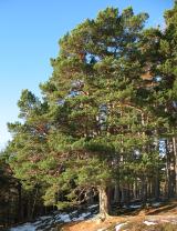 Scots Pine9.7 mi
Explorer Tom Scots Pine has a rivalry with a more famous place down the road that gets all the visitors and the photo ops. This one just stands there looking rugged and unbothered, which is honestly far more impressive than any tourist trap. Best enjoyed with a bag of chips and no plans.
More mountains and hills in County Mayo · All of County Mayo

What do you know about this place?Tap to add a comment or ask a question