
What is recorded here
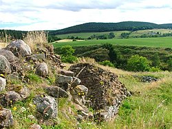
Map note: The map marks Balnagowan Hill as a mountain or peak near Coull, Aberdeenshire, Scotland. That sounds like a place for a big view, though the map makes no promises.
From OpenStreetMap (© OpenStreetMap contributors) n2434101145
Places near here
Picture notes
- Computer-made picture. It does not show this monument.
- Stanley Howe, Wikimedia Commons · CC BY-SA 2.0
- Alan Reid, Wikimedia Commons · CC BY-SA 2.0
- Richard Webb, Wikimedia Commons · CC BY-SA 2.0
- Computer-made picture. It does not show this walking route.
- Mick Garratt, Wikimedia Commons · CC BY-SA 2.0
- Steven Brown, Wikimedia Commons · CC BY-SA 2.0
- Anne Burgess, Wikimedia Commons · CC BY-SA 2.0
 Roadside CottageBoundary Stone (19th Century) · 632 ydComputer-made picture
 BalnagowanCairnfield, Field System · 678 ydComputer-made picture
 North BalnagowanFarmstead · 1007 yd
 Coull Home FarmFarmstead (19th Century), Mill (19th Century) · 1079 yd
 Court HillMountain / peak · 1265 yd
 Craig FerrarMountain / peak · 1697 yd
 Tarland WayWalking route · 1744 ydComputer-made picture
 Coull CastleCastle (medieval), Coin(s) · 1.1 mi
 AboyneNo Class (event) · 1.3 mi
 Braeroddach LochNo Class (event) · 1.3 mi
 Tarland Way (off-road route)Walking route · 1.4 miComputer-made picture
 Aboyne CastleCastle (17th Century), Country House (18th Century), Hospital (first World War), Motte (medieval) · 1.7 mi
More mountains and hills in Aberdeenshire · All of Aberdeenshire

What do you know about this place?Tap to add a comment or ask a question