
What is recorded here
Places near here
Picture notes
- Computer-made picture. It does not show this monument.
- Computer-made picture. It does not show this garden.
- National Inventory of Architectural Heritage
- Computer-made picture. It does not show this mountain top.
- Computer-made picture. It does not show this playground.
- Computer-made picture. It does not show this walking route.
- John M, Geograph · CC BY-SA 2.0
- Roger Diel, Geograph · CC BY-SA 2.0
- PDphoto.org, Wikimedia Commons · Public domain
 Fulacht fia in Formoyle EastFulacht fia · 29 ydComputer-made picture
Explorer Tom Fulacht fia in Formoyle East is a burnt stone horseshoe that smells like ancient barbecue. The mother-in-law who designed it hated everything. If it’s closed, admire it from the road like a polite stalker.
 Caher Bridge GardenGarden · 164 ydComputer-made picture
Explorer Tom Caher Bridge Garden, a garden in County Clare, is a place where history and beauty meet in a quiet, deliberate way.
 Formoyle Chilrens Burial GroundBurial ground · 641 ydComputer-made picture
Explorer Tom Formoyle Chilrens Burial Ground has views that make you want to check your phone. The Vikings definitely got lost looking for this specific patch of grass. Stand where the owner stood and practise looking smug.
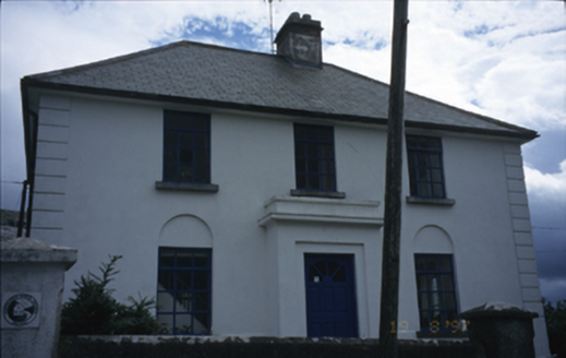 garda station/constabulary barracks1.2 mi
Explorer Tom Garda station in Fanore More is now a hostel, so the ghosts have to share a bathroom with backpackers. I bet a poet fell in the ditch nearby trying to find inspiration. Bring a jacket, it's never as warm as I promise you it will be.
 Gleninagh MountainMountain / peak · 1.2 miComputer-made picture
Explorer Tom Gleninagh Mountain is a quiet sentinel in the landscape, its summit crowned with the silence of ancient times and the stillness of the Clare countryside.
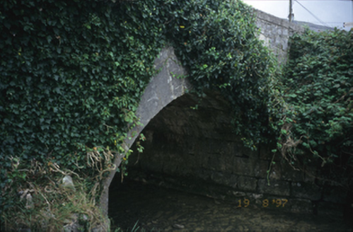 Fanore BridgeBridge · 1.2 mi
Explorer Tom Fanore Bridge in Fanore More spans the river like it owns the place, which it probably does. I bet there's a biscuit tin of gold under that arch. Bring a flask and pretend you own the whole damn river too.
 Children's playground1.4 miComputer-made picture
Explorer Tom Another children's playground that’s a haven for young adventurers in the heart of County Clare.
 DoughbranneenMountain / peak · 1.5 miComputer-made picture
Explorer Tom Doughbranneen is a quiet sentinel in the landscape, its summit crowned with the silence of ancient times and the stillness of the Clare countryside.
 Fanore to Ballyvaughan TrekWalking route · 1.5 miComputer-made picture
Explorer Tom Fanore to Ballyvaughan Trek in County Clare is a trek, not just a walk! That means serious effort. Bring water and maybe a map, unless you're brave!
 Fanore BeachVisitor information · 1.6 mi
Explorer Tom Fanore Beach has me checking if the rain is just a metaphor for the mood I'm in
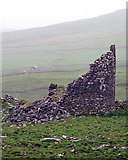 Faunarooska Castle (in ruins)Castle, tower house · 2.2 mi
Explorer Tom Faunarooska Castle in Faunarooska is planning its retirement on the slopes of Slieve Elva. It looks like it’s napping with one eye open at the Aran Islands. Hum something sad nearby, it adds atmosphere.
 Gleninagh CastleCastle · 2.2 mi
Explorer Tom Gleninagh Castle stands proudly in County Clare, guarding secrets of the past with its historic stone walls.
More walking routes in County Clare · All of County Clare

What do you know about this place?Tap to add a comment or ask a question