What is recorded here
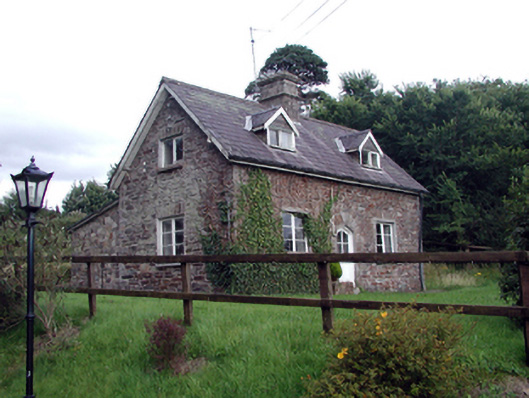
Situated on the SW shore of the King's Channel, a loop of the River Suir. Described as a decayed castle (WA010-006001-) owned by the Dobbin family in 1640 (Simington 1942, 152). A rectangular house of five bays, two floors and an attic, possibly late 17th century in date, incorporating part of an earlier tower house (WA010-006001-). A 17th-century fireplace was discovered during renovations. Ballynakill church site (WA010-007001-) is adjacent to the SSE. (Bence-Jones 1978, 17; Decie 1983, 52)
Bence-Jones, M. (1978) Burke's guide to country houses, vol. 1, Ireland. Burke's Peerage Ltd., London.
Decie (1983) Old Waterford Society survey. Decies No. 16, 24, 42-57.
Compiled by: Michael Moore
Date of upload: 10 November 2010
The monument record does not grant public access. Check the route and ask the landowner before entering private land.
- What survives
- Recorded monument
Places near here
 Ballynakill Househouse · 1 yd
 Burial GroundGraveyard · 65 yd
 Waterford Castleworker's house · 399 yd
 Ballinakill WoodsWood · 659 yd
 Fulacht fia in CoveFulacht fia · 1383 yd
 Monterey CypressMonterey Cypress · 1499 yd
 Bishop's Palace MuseumMuseum · 1.9 mi
 9/11 MemorialMemorial · 1.9 mi
 Granny CastleCastle, tower house · 4.6 mi
 Sugar Loaf RockMountain / peak · 5.1 mi
 Corluddy Castle (in Ruins)Castle, tower house · 6.0 mi
 Mount Congreve GardensHeritage attraction · 6.2 mi