What is recorded here
Described in 1682 by Nicholas Dowdall as a stone bridge at 'Balnacarrow [Ballynacarrow] so called from a fishing near the River' (Gillespie and Moran 1991, 209). In the same year the bridge was described by Sir Henry Piers of Tristernagh as a 'late built bridge, not much more than of twenty years standing. The situation of this bridge (however it was built till our days) seemeth to have been laid out by nature, for it is founded on a rock, which lay always conspicuous (unless in great floods) in a straight line across the river, and at just distances to receive and sustain the arches of a bridge' (Vallancey 1786, 4-5). Present remains consist of a single-arched 19th or 20th-century bridge spanning the River Inny. On the Longford side of this bridge to the NW there is evidence of an earlier bridge consisting of five arches which appears to have been associated with a Corn Mill that is indicated on the first edition of the OS 6-inch map. This earlier bridge may incorporate remains of the 17th-century bridge described by Nicholas Dowdall.
Compiled and revised by: Caimin O'Brien
Date of revised upload: 6 December 2016
The monument record does not grant public access. Check the route and ask the landowner before entering private land.
- What survives
- Recorded monument
Places near here
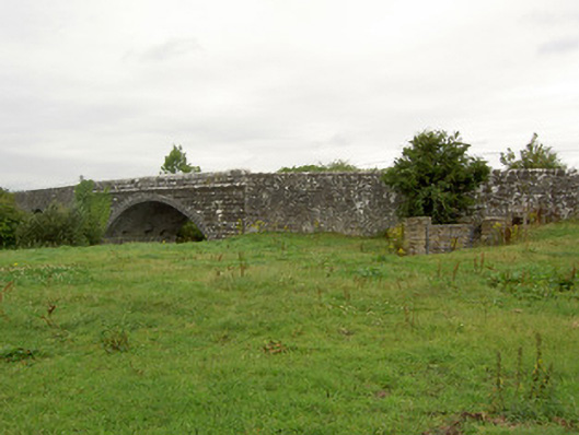 Ballynacarrow Bridgebridge · 2 yd
 Church (in Ruins)Church · 859 yd
 OutlinedHoly well · 964 yd
 Enclosure in AgharraEnclosure · 1381 yd
 Bawn in EmperBawn · 1.3 mi
 European BeechEuropean Beech · 1.7 mi
 Common AlderCommon Alder · 1.9 mi
 Abbeyshrule AbbeyRuins · 2.2 mi
 Site of CastleCastle, unclassified · 2.2 mi
 Goldsmith Birthplace, PallasVisitor information · 4.2 mi
 Craft WorkshopHeritage attraction · 4.6 mi
 Guest ServicesVisitor information · 4.6 mi