What is recorded here
Depicted as 'Ballyneen School' on OS 6-inch map (1842); three-bay, 2-storey, gable-ended structure; pointed ground floor windows; large rectangular 1st floor windows on N elev.; original glazing bars throughout. Pointed doorway in E wall; lean-to along S and W walls.
The above description is derived from the published 'Archaeological Inventory of County Cork. Volume 1: West Cork' (Dublin: Stationery Office, 1992). In certain instances the entries have been revised and updated in the light of recent research.
Date of upload/revision: 14 January 2009
The monument record does not grant public access. Check the route and ask the landowner before entering private land.
- What survives
- Recorded monument
Places near here
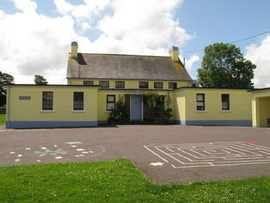 Ballymoney National Schoolschool · 47 yd
 Ballineen BrBridge · 135 yd
 Courthouse in Derrigra (carbery East (w.d.) By., Kinneigh Par.)Courthouse · 495 yd
 Fulacht fia in Derrigra (carbery East (e.d.) By., Ballymoney Par.)Fulacht fia · 1148 yd
 The GlenWood · 1.2 mi
 Irish National Forestry FoundationNature reserve · 2.1 mi
 Corran HillMountain / peak · 2.2 mi
 Castle DerryCastle · 2.3 mi
 Castle RockNamed rock · 2.6 mi
 Ballynacarriga CastleCastle, tower house · 3.9 mi
 Tobar MacloonaboySpring · 4.0 mi
 Green HillMountain / peak · 4.9 mi