What is recorded here
Internal diam. c. 17m. A subcircular area now surrounded by a very, collapsed and overgrown stone wall. The estimated width of this wall is c. 1.3m. Two field boundaries now cross and meet inside the monument. It is situated just below the crest of a rise on land sloping steeply to the SE. The above description was derived from the 'Archaeological Survey of County Donegal. A description of the field antiquities of the County from the Mesolithic Period to the 17th century.' Compiled by: Brian Lacey with Eamon Cody, Claire Cotter, Judy Cuppage, Noel Dunne, Vincent Hurley, Celie O'Rahilly, Paul Walsh and Seán Ó Nualláin (Lifford: Donegal County Council, 1983).
From the National Monuments Service (Archaeological Survey of Ireland) record DG053-022
The monument record does not grant public access. Check the route and ask the landowner before entering private land.
- What survives
- Recorded monument
Places near here
Photo credits
- National Inventory of Architectural Heritage
- Andreas F. Borchert, Wikimedia Commons · CC BY-SA 4.0
- Me, Wikimedia Commons · Public domain
- DevelopedMadness at English Wikipedia, Wikimedia Commons · Public domain
- Kenneth Allen, Geograph · CC BY-SA 2.0
- Dr Neil Clifton, Geograph · CC BY-SA 2.0
- Kenneth Allen, Wikimedia Commons · CC BY-SA 2.0
- Sitomon, Wikimedia Commons · CC BY-SA 2.0
- Eeno11, Wikimedia Commons · CC BY-SA 3.0
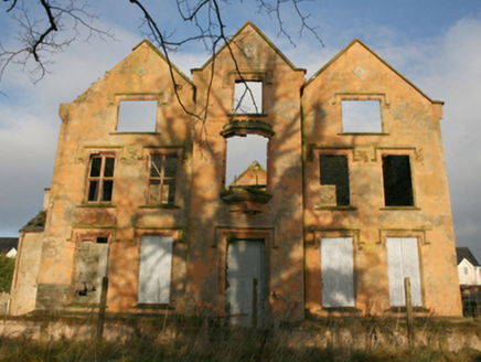 Ballymacool HouseCountry house · 930 yd
 Conwal Old ChurchChurch · 1064 yd
 Conwal Wheeled Cross SlabCross-slab · 1071 yd
 Godfrey O'Donnell GraveslabGraveslab · 1071 yd
 Battle of ScarrifholisBattle · 1.5 mi
 Donegal County MuseumMuseum · 1.6 mi
 Gregory HillMountain / peak · 1.9 mi
 Newmills Corn and Flax MillsHeritage attraction · 1.9 mi
 Stackarnagh Abbey GraveyardGraveyard · 3.6 mi
 European Yew5.7 mi
 Rowan5.7 mi
 Mongorry HillMountain / peak · 7.2 mi
More archaeology and monuments in County Donegal · All of County Donegal
What do you know about this place?