What is recorded here
From OpenStreetMap (© OpenStreetMap contributors) w531494645
Places near here
Photo credits
- A.-K. D., Wikimedia Commons · CC BY-SA 4.0
- A.-K. D., Wikimedia Commons · CC0
- National Inventory of Architectural Heritage
- Rüdiger Wölk This photo was taken by Rüdiger Wölk . Please credit this photo Rüdiger Wölk, Münster . View all photos (large page) of Rüdiger Wölk I would also appreciate an email to rudiger.wolk@gmail.com with details of use. Für Hinweise auf Veröffentlichungen (rudiger.wolk@gmail.com) oder Belegexemplare bin ich Ihnen dankbar., Wikimedia Commons · CC BY-SA 2.5
- Mike Searle, Wikimedia Commons · CC BY-SA 2.0
- Sarah777 at en.wikipedia, Wikimedia Commons · Public domain
- kevin higgins, Geograph · CC BY-SA 2.0
 Abbey in ruinsChurch · 682 yd
Explorer Tom Abbey in ruins in Ballylarkin Upper claims to be an abbey, but it’s just a parish church pretending. Its first owner escaped via a tunnel that probably led straight to the pub. A handy spot to stretch your legs and your imagination.
 CastleCastle, motte · 701 yd
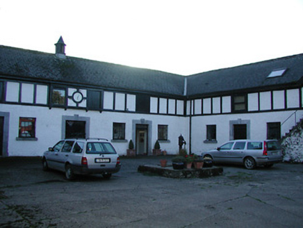 Uppercourt HouseStables · 796 ydFreshford LoopWalking route · 845 yd
 TobernapeastiaHoly well · 1273 yd
Explorer Tom Tobernapeastia is feuding with the rain because it thinks the muck is making it look bad. People used to wash their hands here for worms, but now it’s just a hollow. Look for the ghost, then pretend you didn't.
 Font in Freshford LotsFont · 1711 yd
Explorer Tom Font in Freshford Lots is playing hide-and-seek with me. It gave up its cover for Lent and now sits on a modern pedestal looking thoroughly confused about its own history. Bring the dog, it'll have opinions.
 Red horse-chestnut1738 yd
 Emma Jane Browne-ClaytonMemorial · 1.0 mi
 Balleen Castle (ruins)Castle · 2.1 mi
 Clomantagh HillMountain / peak · 3.8 mi
 Wellington MonumentViewpoint · 6.2 mi
More archaeology and monuments in County Kilkenny · All of County Kilkenny

What do you know about this place?Tap to add a comment or ask a question