What is recorded here
Situated on flat pasture with extensive views; destroyed castle site (TN048-007) immediately to S. An impressive large circular area (diam. 75m N-S) enclosed by a large flat-topped earth and stone bank (Wth 3m; int. H 1.8m; ext. H 2.5-5m) with traces of an infilled fosse and destroyed entrance gap (Wth 10m) at SSE. The vertical nature of the bank's inner face is probably due to the cleaning of the bank face by a bulldozer. Vol. 1 - North Tipperary' compiled by Jean Farrelly and Caimin O'Brien (Dublin: Stationery Office, 2002).
Situated on flat pasture with extensive views; destroyed castle site (TN048-007) immediately to S. An impressive large circular area (diam. 75m N-S) enclosed by a large flat-topped earth and stone bank (Wth 3m; int. H 1.8m; ext. H 2.5-5m) with traces of an infilled fosse and destroyed entrance gap (Wth 10m) at SSE. The vertical nature of the bank's inner face is probably due to the cleaning of the bank face by a…
From the National Monuments Service (Archaeological Survey of Ireland) record TN048-006
The monument record does not grant public access. Check the route and ask the landowner before entering private land.
- What survives
- Recorded monument
Places near here
 Sweet Chestnut1053 yd
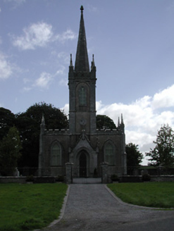 Saint Mary's Church (Twomileborris)Church/chapel · 1414 yd
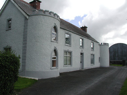 Castle ViewHouse · 1523 yd
 European ash1.1 mi
 Ballybeg CastleCastle · 1.1 mi
 CastleCastle, tower house · 1.8 miDerrynaflan TrailHeritage attraction · 2.8 miHorse and JockeyVisitor information · 2.8 mi
 IndicatedEcclesiastical site · 3.0 mi
 Sheela-na-gig in LeighSheela-na-gig · 3.0 miGobban Saer's GraveArchaeological place · 3.5 mi
 Lár na PáirceMuseum · 4.0 mi
Pictures: Miguel Angel Masegosa Martínez, Wikimedia Commons · CC BY 2.0; National Inventory of Architectural Heritage; Willow, Wikimedia Commons · CC BY 2.5; Mike Searle, Wikimedia Commons · CC BY-SA 2.0; Martin Richard Phelan, Geograph · CC BY-SA 2.0; Wanfried-Dublin, Wikimedia Commons · CC BY-SA 3.0; A.-K. D., Wikimedia Commons · CC BY-SA 4.0; Lár na Páirce Museum, Wikimedia Commons · CC BY 2.0
More archaeology and monuments in County Tipperary · All of County Tipperary
What do you know about this place?