What is recorded here
On the N slopes of a ridge with an extensive view WSW–N and defended by naturally steep ground to SW and W. Hachured and named ‘Balliny Caher’ on the 1842 and 1915 eds. of the OS 6-inch maps. On the 1842 ed. a village of c. 17 houses is depicted within and surrounding the cashel. O’Donovan wrongly recorded it in 1839…
Read the whole record
From the National Monuments Service (Archaeological Survey of Ireland) record CL004-016004
Places near here
Photo credits
- Maker not stated on source page, en.wikipedia.org
- Maker not stated on source page, www.gettyimages.com
- P L Chadwick, Geograph · Creative Commons Attribution-ShareAlike 2.0
- Maker not stated on source page, en.m.wikipedia.org
- Maker not stated on source page, commons.wikimedia.org
- Maker not stated on source page, storage.googleapis.com
- Roger Diel, Geograph · CC BY-SA 2.0
- The original uploader was Rwxrwxrwx at English Wikipedia ., Wikimedia Commons · CC BY-SA 3.0
- Andy Waddington, Wikimedia Commons · CC BY-SA 2.0
 Killonoghan Church (in ruins)Church · 454 yd
Explorer Tom Killonoghan Church has a secret talent for making you feel small near the foreshore. St Onchon founded it, and…
 Craggagh CemeteryCemetery · 463 yd
Explorer Tom Craggagh Cemetery in County Clare hosted a dance one night that went way too far, with the ghosts getting a bit rowdy…
 Grave YardGraveyard · 467 yd
Explorer Tom Graveyard in Craggagh would cope brilliantly on a reality show because it has great views and zero drama. St. Onchon…
 Enclosure in BallyellyEnclosure · 941 yd
Explorer Tom Enclosure in Ballyelly has a smuggling story that’s total rubbish. They say they hid whiskey in the rocks, but I bet…
 Fairy fort / earthen ringfort in CraggaghFairy fort / earthen ringfort · 972 yd
Explorer Tom Fairy fort / earthen ringfort in Craggagh is entirely under the management of a very aggressive terrier who thinks he…
Fairy fort / stone ringfort in CraggaghFairy fort / stone ringfort · 1090 ydExplorer Tom Fairy fort / stone ringfort in Craggagh would give its visitors two stars because they walked through the mud and…
 Fairy fort / stone ringfort in BallyellyFairy fort / stone ringfort · 1165 yd
Explorer Tom Fairy fort / stone ringfort in Ballyelly is a mystery that hasn't been properly uploaded yet, so it’s basically just a…
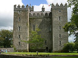 Baunarooska CastleRuins · 1218 yd
Explorer Tom Baunarooska Castle hears everything through its walls, including your internal monologue about how hungry you are right…
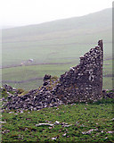 Faunarooska Castle (in ruins)Castle, tower house · 1227 yd
Explorer Tom Faunarooska Castle watched the Vikings get completely lost looking for it because they were too busy fighting over who…
 Oughtdarra Church (in Ruins)Church · 3.4 mi
Explorer Tom Oughtdarra Church in Oughtdarra is whispering sweet nothings to the place that replaced it. It’s just a hollow now, but…
 AilladieCliff · 3.4 mi
Explorer Tom Ailladie is eight hundred metres of Clare limestone that makes climbers grin and makes me check where my feet are. The…
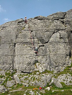 BallyryanCliff · 3.6 mi
Explorer Tom Ballyryan is the Burren crag that seems to have wandered up beside the coast road to show the bigger cliffs how to…
More archaeology and monuments in County Clare · All of County Clare

What do you know about this place?Tap to add a comment or ask a question