What is recorded here
Ballifeary is an axehead in Highland, Scotland.
From the Historic Environment Scotland record 13496
The historic-place record does not grant public access. Check current conditions and ownership before entering land or a building.
Places near here
Photo credits
- Douglas Nelson, Wikimedia Commons · CC BY-SA 2.0
- Steven Brown, Wikimedia Commons · CC BY-SA 2.0
- Colin Prosser, Wikimedia Commons · CC BY-SA 2.0
- Bill Boaden, Wikimedia Commons · CC BY-SA 2.0
- Liz Gray, Wikimedia Commons · CC BY-SA 2.0
- Dave Thompson, Wikimedia Commons · CC BY-SA 2.0
- James Denham, Wikimedia Commons · CC BY-SA 2.0
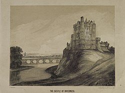
- This image is available from the National Library of Scotland under the sequence number or Shelfmark ID Blaikie.SNPG . You can see this image in its original context, along with the rest of the Library's digital collections, under digital.nls.uk/75242258 in the NLS Digital Gallery, Wikimedia Commons · Public domain
- John Allan, Wikimedia Commons · CC BY-SA 2.0
- Craig Wallace, Wikimedia Commons · CC BY-SA 2.0
- Ian S, Wikimedia Commons · CC BY-SA 2.0
 Loch Na SanaisAxehead (stone) · 450 yd
 TorveanBoundary Wall(s), Burial Cairn (possible), Structure(s) (post Medieval) · 513 yd
 Inverness, Caledonian Canal, Tomnahurich Swing BridgeSwing Bridge · 571 yd
 Inverness, Caledonian Canal, Tomnahurich Bridge Keeper's CottageBridge Keepers Cottage (19th Century) (1820) · 593 yd
 Inverness, Glenurquhart Road, Tomnahurich Cemetery, ShelterShelter · 739 yd
 Burma Campaign War MemorialMemorial · 1694 yd
 Craigphadrig ForestForest · 1.1 mi
 Inverness CastleNo Class (event) · 1.2 mi
 Siege of InvernessSiege · 1.2 mi
.jpg/250px-Inverness_Museum_and_Art_Gallery_(geograph_2180826).jpg "Photo: John Allan, Wikimedia Commons · CC BY-SA 2.0") Inverness Museum & Art GalleryMuseum · 1.2 mi
Inverness Museum & Art GalleryMuseum · 1.2 mi Abertarff HouseMuseum · 1.3 mi
 The Old High Church of InvernessVisitor information · 1.3 mi
More archaeology and monuments in Highland · All of Highland
What do you know about this place?