What is recorded here
Bagh Uaigneach is a farmstead in Highland, Scotland.
Places near here
Photo credits
- Bob Jones, Wikimedia Commons · CC BY-SA 2.0
- Helmut Zozmann, Wikimedia Commons · CC BY-SA 2.0
- Mick Garratt, Wikimedia Commons · CC BY-SA 2.0
- jeff collins, Wikimedia Commons · CC BY-SA 2.0
- Trevor Rickard, Wikimedia Commons · CC BY-SA 2.0
- sylvia duckworth, Wikimedia Commons · CC BY-SA 2.0
- david glass, Wikimedia Commons · CC BY-SA 2.0
- Alan Reid, Wikimedia Commons · CC BY-SA 2.0
- Toby Speight, Wikimedia Commons · CC BY-SA 2.0
- Florian Fuchs, Wikimedia Commons · CC BY 3.0
 Rispond, Fishing Station, Pier and QuayPier, Quay · 1107 yd
 RispondTownship · 1119 yd
 An t-AigeachHeadland · 1325 yd
 Rubh' an DaimhHeadland · 1690 yd
 Tràigh Allt ChàilgeagBeach / strand · 1.1 mi
 CeannabeinneEnclosure · 1.3 mi
 Traigh Na H'uamhagMonastery (possible) · 1.3 mi
 Sgeir a' BhuicIsland · 1.3 mi
 Ben HeilamMountain / peak · 1.9 mi
 A' Ghoil-sgeirIslet · 2.2 mi
 Cnoc nan GobharMountain / peak · 2.3 mi
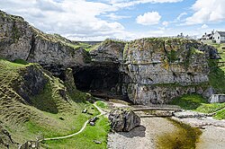 Smoo CaveCave(s), Midden, Pin(s) (bone) · 2.8 mi
More historic places in Highland · All of Highland

What do you know about this place?Tap to add a comment or ask a question