
What is recorded here
Back Hill is a mountain or peak in Dumfries and Galloway, Scotland.
From OpenStreetMap (© OpenStreetMap contributors) n2856803267
This does not grant access. Check current paths, opening conditions and ownership before entering.
Places near here
Photo credits
- Steven Brown, Wikimedia Commons · CC BY-SA 2.0
- Colin Kinnear, Wikimedia Commons · CC BY-SA 2.0
- Oliver Dixon, Wikimedia Commons · CC BY-SA 2.0
- James Denham, Wikimedia Commons · CC BY-SA 2.0
- Milestone Society, Wikimedia Commons · CC BY-SA 2.0
- David Dixon, Wikimedia Commons · CC BY-SA 2.0
- Richard Webb, Wikimedia Commons · CC BY-SA 2.0
- Neil Owen, Wikimedia Commons · CC BY-SA 2.0
- Chris Newman, Wikimedia Commons · CC BY-SA 2.0
 DamheadFarmstead · 882 yd
 TinwaldshawsFarmstead · 1613 yd
 AmisfieldFlake (flint) · 1.0 mi
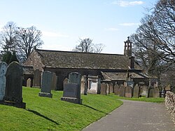 TinwaldBurial Ground (20th Century) · 1.1 mi
 Crochmade WoodWood · 1.7 mi
 Ryemuir WoodWood · 2.1 mi
 Memorial GardenMemorial · 2.7 mi
 Torthorwald CastleCastle (medieval), Earthwork(s), Motte (medieval) (possible), Tower House (medieval) · 2.7 mi
 Dumfries and Galloway Aviation MuseumMuseum · 2.7 mi
 DumfriesVessel (bronze)(medieval) · 2.8 mi
 Gamerigg CemeteryCemetery (20th Century) · 2.9 mi
 CarzieldFarmhouse, Tower House (medieval) · 3.1 mi
More mountains and hills in Dumfries and Galloway · All of Dumfries and Galloway
What do you know about this place?