What is recorded here
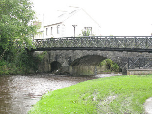
Athea Bridge gave the river three arches and left so little room upstairs that pedestrians eventually got a bridge of their own. A grand Irish host: plenty of room for the drink, nowhere for the guests.
Freestanding triple-arch road bridge, built c. 1820, comprising central primary camber-headed arch flanked by smaller camber-headed arches having rusticated limestone voussoirs with tooled limestone soffits springing from tooled limestone piers. Tooled limestone V-cutwaters to side (south) elevations having tooled limestone capping. Snecked rusticated limestone spandrels below roughly dressed stone parapet walls having tooled limestone coping and piers to termini with pyramidal tooled limestone capping. Rusticated stone-faced embankments to banks (east, west) flanking bridge having square-profile piers with rusticated stone coping and capping. Recent single-span iron girder footbridge, c. 2005, to south of bridge. Located at the east end of Athea.
Located on the edge of the town of Athea, this striking bridge not only forms a boundary marker for the town, but is also an important part of the town's architectural heritage. The effort of the engineers and masons is clearly visible throughout the bridge's construction, with substantial amounts of tooled and dressed stone forming its main fabric. Symmetrically designed with smaller aches flanking the large central arch, architectural details such as rusticated voussoirs and tooled limestone coping and cutwaters enliven the façades. The narrow form of the bridge attests to its age and explains the construction of the adjacent pedestrian footbridge.
From the Buildings of Ireland (National Inventory of Architectural Heritage) record 21834011
This does not grant access. Most recorded buildings are privately owned; view them only from public ground unless the owner allows entry.
Places near here
Photo credits
- National Inventory of Architectural Heritage
- jonleebotany, Wikimedia Commons · CC0
- Garry Dickinson, Wikimedia Commons · CC BY-SA 2.0
- Philip Halling, Geograph · CC BY-SA 2.0
- N Chadwick, Geograph · CC BY-SA 2.0
- No machine-readable author provided. Larsoner~commonswiki assumed (based on copyright claims)., Wikimedia Commons · Public domain
- Unknown author Unknown author, Wikimedia Commons · Public domain
- Borvan53, Wikimedia Commons · CC BY-SA 3.0
- Colin Park, Geograph · CC BY-SA 2.0
- Charles W Glynn, Wikimedia Commons · CC BY-SA 2.0
- P L Chadwick, Geograph · CC BY-SA 2.0
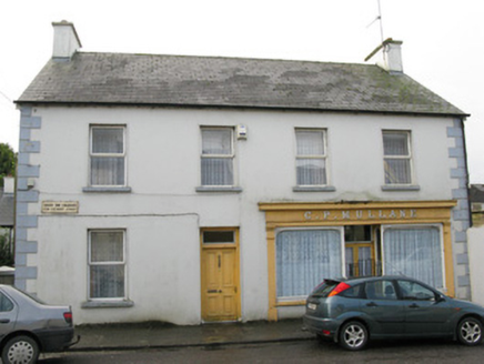 C.p. MullaneHouse · 40 yd
 handball alley63 yd
 Lawson's Cypress1539 yd
 Glin CastleCastle · 7.5 mi
 John B. KeaneMemorial · 8.0 mi
 John B. KeaneMemorial · 8.4 mi
 Listowel Castle (in ruins)Castle, tower house · 8.5 mi
 Lartigue MonorailMuseum · 8.6 mi
 Siege of Carrigafoyle CastleSiege · 12 mi
 Carrig IslandIsland · 12 mi
 Scattery IslandIsland · 14 mi
 Scattery Island Visitor CentreVisitor information · 14 mi
More historic places in County Limerick · All of County Limerick
What do you know about this place?