
What is recorded here
From the National Monuments Service (Archaeological Survey of Ireland) record RO048-108003
Places near here
Photo credits
- Maker not stated on source page, www.roscommonherald.ie
- Maker not stated on source page, www.geograph.ie
- Maker not stated on source page, irishheritagenews.ie
- Maker not stated on source page, www.tripadvisor.in
- Maker not stated on source page, fi.pinterest.com
- Maker not stated on source page, www.thejournal.ie
- Maker not stated on source page, storage.googleapis.com
- Maker not stated on source page, wanderaroundireland.com
- Kmcnamee, Wikimedia Commons · CC BY-SA 4.0
- Mountbellew Golf Club; photographer not stated, Mountbellew Golf Club
- Maker not stated on source page, www.visitgalway.ie
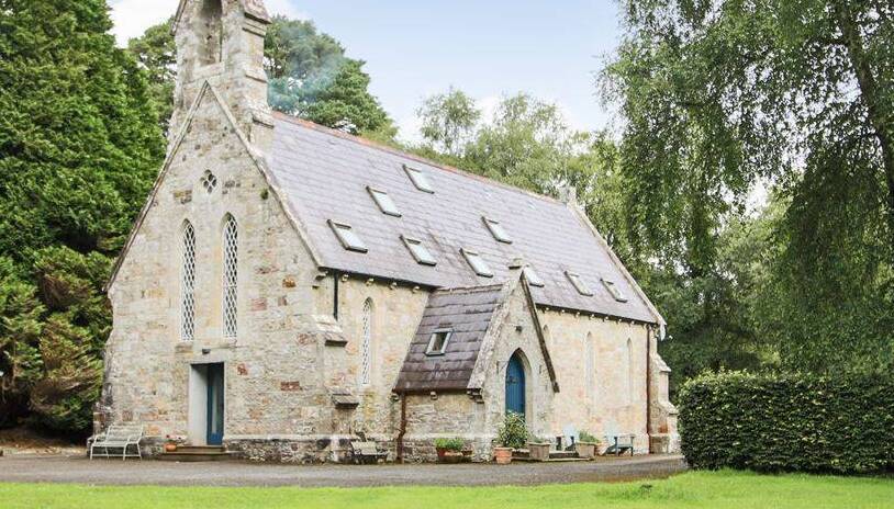 Church in BrideswellChurch · 236 yd
Explorer Tom Church in Brideswell would post on social media about how it used to be cool before everyone forgot where it was. It’s…
 Graveyard in BrideswellGraveyard · 236 yd
Explorer Tom Graveyard in Brideswell was the site of a massive feud between two families over who owned the best view of the river.…
 Fairy fort / earthen ringfort in CornageehaFairy fort / earthen ringfort · 1.0 mi
Explorer Tom Fairy fort / earthen ringfort in Cornageeha gave up chocolate for Lent but kept the mud, which shows true commitment to…
 Castle NaghtanCastle, unclassified · 1.2 mi
Explorer Tom Castle Naghtan thinks it's a dating agency because someone got married here in the sixteenth century and hasn't stopped…
 Mapped cemeteryCemetery · 1.7 mi
Explorer Tom Right next to this Mapped Cemetery in Roscommon, there was a love story that ended with someone throwing a shoe at a…
 Fairy fort / stone ringfort in FeacleFairy fort / stone ringfort · 1.9 mi
Explorer Tom Fairy fort / stone ringfort in Feacle is a D-shaped feature that only shows up on aerial photos because it’s too shy to…
 Fairy fort / stone ringfort in Carrowkeeran,corkipFairy fort / stone ringfort · 1.9 mi
Explorer Tom Fairy fort / stone ringfort in Carrowkeeran, Corkip is defined by a drystone wall that the seagulls use as a perch to…
 Cloonbigny CastleHouse, 16th/17th century · 5.7 mi
Explorer Tom Cloonbigny Castle thinks it’s the star of the show, but it’s really just a guy built on top of another guy’s leftovers.…
 Mountbellew - Moylough GAA pitchGAA ground · 17 mi
 Mountbellew Golf ClubGolf course · 18 mi
 CastleCastle, tower house · 20 mi
Explorer Tom Castle in Glinsk is playing hide-and-seek with me. A tale from 1574 says Hubert Burke had it, but he's long gone and so…
 Glinsk CastleVisitor attraction · 20 mi
Explorer Tom Glinsk Castle smells like a mix of old books, wet stone, and whatever the ghosts were having for dinner last night…
More archaeology and monuments in County Roscommon · All of County Roscommon

What do you know about this place?Tap to add a comment or ask a question