What is recorded here
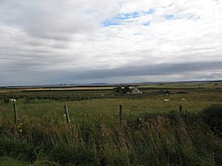
Ardwin is a ring ditch in Highland, Scotland.
Places near here
Photo credits
- Ian Balcombe, Wikimedia Commons · CC BY-SA 2.0
- Paul Simonite, Wikimedia Commons · CC BY-SA 2.0
- david glass, Wikimedia Commons · CC BY-SA 2.0
- David Bremner, Wikimedia Commons · CC BY-SA 2.0
- Peter Gamble, Wikimedia Commons · CC BY-SA 2.0
- Phil Williams, Wikimedia Commons · CC BY-SA 2.0
- Jim Bain, Wikimedia Commons · CC BY-SA 2.0
- N Chadwick, Wikimedia Commons · CC BY-SA 2.0
- Paul E Smith, Wikimedia Commons · CC BY-SA 2.0
 WattenMound · 436 yd
 Watten, Cross Roads, Old Toll HouseToll House (post Medieval) · 825 yd
 Watten, SmithySmithy · 873 yd
 Watten Drill HallDrill Hall (19th Century) - (20th Century), Drill Hall (first World War), Village Hall (19th Century) - (20th Century) · 899 yd
 Watten War MemorialMemorial · 904 yd
 Wester Watten MossForest · 2.9 mi
 Bilbster and Stirkoke War MemorialMemorial · 4.0 mi
 Achlachan MossForest · 5.8 mi
 Battle of HarpsdaleBattle · 7.6 mi
 Dirlot CastleCastle (medieval) · 8.0 mi
 Castlehill Heritage CentreMuseum · 8.8 mi
 Dunnet BeachBeach / strand · 9.2 mi
More archaeology and monuments in Highland · All of Highland

What do you know about this place?Tap to add a comment or ask a question