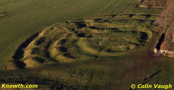
What is recorded here
Ballycran More in County Down still hides a possible enclosure, perhaps a rath, visible only through cropmarks rather than stone. The uncertainty is not a flaw but an invitation: the land may be revealing a shape that people forgot or never wrote down. Walk its edge at dawn and watch for shallow dips, changed soil colour or grass that grows differently. If the field presents a circle, angle or broken line, record what it shows without forcing it into a known category.
The official Northern Ireland record identifies this as AP Cropmark- Possible enclosure (rath?). Recorded period: UNCERTAIN. The official map point was placed at the centre of the recorded archaeological site from the source map reference.
The monument record does not grant public access. Check the route and ask the landowner before entering private land.
- What survives
- Recorded monument
Places near here
 CHURCH SITE (poss. Pre-Norman) in EchlinvilleCHURCH SITE (poss. Pre-Norman) · 1.1 mi
 ENCLOSURE in BallygraffanENCLOSURE · 1.2 mi
 The Echlinville DistilleryHeritage attraction · 1.2 mi
 Kirkistown CastleCastle · 1.3 mi
 CHURCH (unlocated) in GranshaCHURCH (unlocated) · 2.0 mi
 CHURCH (in ruins) in CastleboyCHURCH (in ruins) · 2.1 mi
 Horse IslandIsland · 2.1 mi
 MOTTE AND BAILEY WITH LATER TOWER-HOUSE: CASTLE HILL in ArdkeenMOTTE AND BAILEY WITH LATER TOWER-HOUSE: CASTLE HILL · 2.3 mi
 CHURCH & GRAVEYARD & COFFIN LIDS (2): ARDKEEN CHURCH in ArdkeenCHURCH & GRAVEYARD & COFFIN LIDS (2): ARDKEEN CHURCH · 2.4 mi
 Pherson's IslandIsland · 2.4 mi
 Windmill HillMountain / peak · 2.4 mi
 Monaghan BankMountain / peak · 2.9 mi
Other information
Photo: Credit not shown in the picture search · Rights wording not checked; contact us if this picture should be removed