
What is recorded here
Map note: Annett Hill is recorded near Westburnflat, Scottish Borders, Scotland as a mountain or peak. The name does the climbing; the map shows where to look.
From OpenStreetMap (© OpenStreetMap contributors) n9381453875
Places near here
Photo credits
- Walter Baxter, Wikimedia Commons · CC BY-SA 2.0
- Richard Webb, Wikimedia Commons · CC BY-SA 2.0
- Oliver Dixon, Wikimedia Commons · CC BY-SA 2.0
- Peter Bond, Wikimedia Commons · CC BY-SA 2.0
- Richard Dear, Wikimedia Commons · CC BY-SA 2.0
- Peter McDermott, Wikimedia Commons · CC BY-SA 2.0
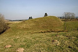 CastletonTownship (medieval) · 225 yd
 Castleton, CrossCross · 264 yd
 Castleton MuirStock Enclosure (post Medieval) · 275 yd
 Liddel CastleEarthwork, Fortification, Motte and Bailey (medieval) · 474 yd
 Castleton, St Martin's Church and ChurchyardBurial Ground, Church (medieval), Church (19th Century) · 493 yd
 RedheughTower House (medieval) · 1715 yd
 Leahaugh BankWood · 1.5 mi
 NewcastletonVisitor information · 1.5 mi
 Swarf HillMountain / peak · 1.5 mi
 Castle HillMountain / peak · 1.7 mi
 The Border StaneSculpture · 2.1 mi
 Steele PlantationForest · 2.4 mi
More mountains and hills in Scottish Borders · All of Scottish Borders

What do you know about this place?Tap to add a comment or ask a question