
What is recorded here
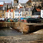
Ann and Christian is a wreck in Fife, Scotland.
Places near here
Photo credits
- Euan Nelson, Wikimedia Commons · CC BY-SA 2.0
- Bill Kasman, Wikimedia Commons · CC BY-SA 2.0
- Jim Bain, Wikimedia Commons · CC BY-SA 2.0
- Richard Sutcliffe, Wikimedia Commons · CC BY-SA 2.0
- John Allan, Wikimedia Commons · CC BY-SA 2.0
- Tim Heaton, Wikimedia Commons · CC BY-SA 2.0
- Derek Harper, Wikimedia Commons · CC BY-SA 2.0
- Sandy Gemmill, Wikimedia Commons · CC BY-SA 2.0
- Maker not stated on source page, www.flickr.com
 Sauchar Point, Lady's TowerCommemorative Monument, Structure · 308 yd
 Saucher Point, Lady's Tower, Vaulted ChamberBath House · 312 yd
 Sauchar PointShell Midden (possible) · 393 yd
 Elie Ness, LighthouseLighthouse (20th Century) · 508 yd
 Wood HavenAnti Tank Blocks (20th Century) · 565 yd
 Ruby BayVisitor information · 707 yd
 Elie, Sea WallSea Defences · 851 yd
 Elie, Wadeslea Road, Coastguard StationCoastguard Station (19th Century) - (20th Century) · 953 yd
 ElieBunker (20th Century) · 964 yd
 Elie HarbourShell Midden (possible) · 971 yd
 William Scott: Elie Pier, Firth of ForthCraft (19th Century) · 1173 yd
 Elie, High Street, HycroftNo Class (event) · 1243 yd
More archaeology and monuments in Fife · All of Fife

What do you know about this place?Tap to add a comment or ask a question