
What is recorded here
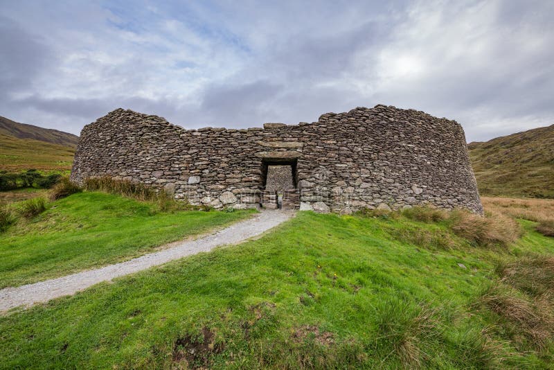
On a level crag terrace in rough pasture, with land sloping to the W and rising to the NE and SE. Within an extensive multiperiod field system (CL005-160001-). Indicated and labelled ‘Ancient Grave’ on the Cassini edition (1920) of the OS 6-inch map. Described by de Valera and Ó Nualláin (1961, 35-6) as a…
Read the whole record
From the National Monuments Service (Archaeological Survey of Ireland) record CL010-006
Places near here
Photo credits
- Maker not stated on source page, www.dreamstime.com
- Maker not stated on source page, en.wikipedia.org
- P L Chadwick, Geograph · Creative Commons Attribution-ShareAlike 2.0
- Maker not stated on source page, www.gettyimages.com
- Maker not stated on source page, kr.pinterest.com
- Oliver Dixon, Wikimedia Commons · CC BY-SA 2.0
- Roger Diel, Wikimedia Commons · CC BY-SA 2.0
- N Chadwick, Geograph · CC BY-SA 2.0
- Colin Park, Geograph · CC BY-SA 2.0
 Fairy fort / stone ringfort in Rannagh WestFairy fort / stone ringfort · 1042 yd
Explorer Tom This oval cashel in Rannagh West has strong opinions on what rabbits think about it. It’s near a cliff edge, which adds…
 Fairy fort / stone ringfort in CragballyconoalFairy fort / stone ringfort · 1132 yd
Explorer Tom Fairy fort / stone ringfort in Cragballyconoal was built on a bargain where a fairy traded a shoe for a hillside. It’s…
 Enclosure in Eanty MoreEnclosure · 1206 yd
Explorer Tom Enclosure in Eanty More has a twin across the sea that’s been texting it all day. I’m not sure who’s lying about whose…
Fairy fort / stone ringfort in CahergrillaunFairy fort / stone ringfort · 1.0 miExplorer Tom Fairy fort in Cahergrillaun is on a knoll where the whole parish argued about whether it was a fort or a very large…
 Saint Columba's Catholic ChurchChurch/chapel · 1.2 mi
Explorer Tom Saint Columba's Catholic Church in Crughwill is basically the village's living room, just with better lighting and more…
 Mapped cemeteryCemetery · 1.3 mi
Explorer Tom Mapped cemetery in County Clare hates delivery drivers who park their vans too close to the headstones, so keep your…
Fairy fort / stone ringfort in CaherconnellFairy fort / stone ringfort · 2.0 miExplorer Tom Fairy fort / stone ringfort in Caherconnell inspired a bad poem once that rhymed 'wall' with 'tall' and 'grass' with…
 Megalithic structure in GlensleadeMegalithic structure · 2.0 mi
Explorer Tom Megalithic structure in Glensleade used to be a heap of stones that got cleared away, leaving just a small cist behind.…
 Noughaval Church (in ruins)Church · 4.1 mi
Explorer Tom Noughaval Church is being picked on by the wind because it stands right on the edge of a slope, which means it gets…
 Caherminnaun Castle (in ruins)Castle, unclassified · 5.6 mi
Explorer Tom Caherminnaun Castle is basically a heap of rubbish that thinks it's a monument. O’Curry said it was 'a heap of ruins'…
 High CrossHeritage attraction · 6.4 mi
Explorer Tom This High Cross had a moment where a fox took charge of the whole site, sitting on top of it looking like a tiny…
 Burren Centre KilfenoraVisitor information · 6.4 mi
Explorer Tom The Burren Centre in Kilfenora is a sensible first stop before trying to make sense of north Clare's limestone hills. I…
More archaeology and monuments in County Clare · All of County Clare

What do you know about this place?Tap to add a comment or ask a question