What is recorded here
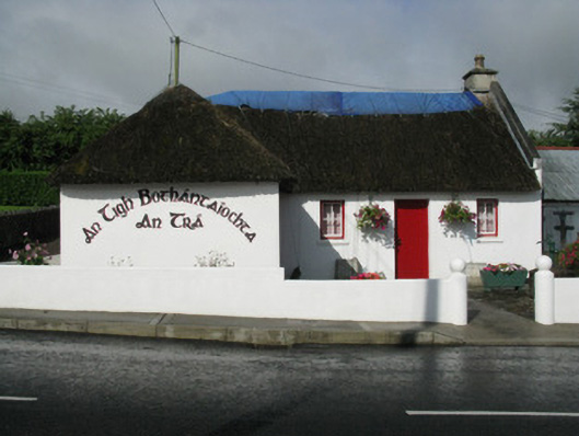
An Tigh Bothántaíochta in Glenmore East has a Dutch door: the top half admits the gossip, while the bottom half keeps the person telling it from settling in for six hours.
Detached L-plan three-bay single-storey thatched former house, built c. 1860. Having two-bay single-storey projecting end-bay front (east). Now in use as community centre. Hipped and pitched thatched roof with rendered chimneystack and render gable coping to side (north). Rendered walls with tooled limestone commemorative plaque to side (north) elevation of projecting end bay. Square-headed window openings with render sills throughout, having replacement four-pane timber casement windows. Square-headed door openings having timber battened Dutch door to front elevation opening and timber battened door to side (north) elevation of projecting end bay. Attached single-bay corrugated-iron former school to side (north) elevation, having pitched roof with double-leaf corrugated-iron doors to front elevation. Rendered enclosing walls with circular profile piers and rendered capping. Cast-iron water pump to east with banded shaft, bucket notch to spout and cow-tail handle mounted on cylindrical-profile pier. Square-profile piers with render capping supporting single-leaf timber battened gate. Located at the south end of the village of Strand.
This pleasant thatched house possesses a charm which is becoming increasingly rare as buildings are modified. The house retains a characteristic Dutch door, timber casement windows and a thatched roof, all of which make a significant contribution to its character and visual appeal. An adjoining corrugated-iron school house adds an air of nostalgia to the site. A plaque is inscribed: "THE ORIGINAL THATCHED/COTTAGE ON THIS SITE WAS/DONATED TO STRAND COMMUNITY/BY THE RELATIVES OF THE LATE/PATRICK HEFFERNAN R.I.P./ON JULY 16TH 1996".
From the Buildings of Ireland (National Inventory of Architectural Heritage) record 21904403
This does not grant access. Most recorded buildings are privately owned; view them only from public ground unless the owner allows entry.
Places near here
Photo credits
- National Inventory of Architectural Heritage
- Mike Searle, Wikimedia Commons · CC BY-SA 2.0
- A.-K. D., Wikimedia Commons · CC BY-SA 4.0
- Jonathan Thacker, Geograph · CC BY-SA 2.0
- jonleebotany, Wikimedia Commons · CC0
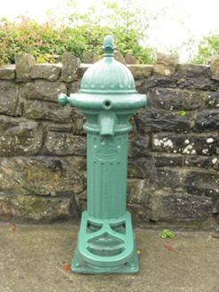 water pump93 yd
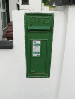 post box179 yd
 Glenquin CastleCastle · 1597 ydMoated site in ArranaghMoated site · 1.5 miEnclosure in CamasEnclosure · 1.5 mi
 Saint Ite's WellSpring · 1.9 miBallagh MountainMountain / peak · 2.5 miTobereenalaffinaSpring · 2.8 miBarnagh HillMountain / peak · 3.4 mi
,_Newcastle_West,_Limerick_-_geograph.org.uk_-_1392672.jpg/250px-Castles_of_Munster,_Desmond_Hall_(Castle_Banqueting_Hall),_Newcastle_West,_Limerick_-_geograph.org.uk_-_1392672.jpg "Photo: Mike Searle, Wikimedia Commons · CC BY-SA 2.0") Templars Castle (in ruins)Castle, Anglo-Norman masonry castle · 4.2 mi
Templars Castle (in ruins)Castle, Anglo-Norman masonry castle · 4.2 mi Three CountiesPicnic place · 8.2 mi
 Lawson's Cypress8.6 mi
More historic places in County Limerick · All of County Limerick
What do you know about this place?