
Places near here
Photo credits
- Colin Park, Geograph · CC BY-SA 2.0
- National Inventory of Architectural Heritage
- Colin Park, Geograph · Creative Commons Attribution-ShareAlike 2.0
- John Martin, Geograph · CC BY-SA 2.0
- Kenneth Allen, Geograph · CC BY-SA 2.0
- Patrice78500, Wikimedia Commons · Public domain
- Ciaran Mac Murchaidh / Geograph Britain and Ireland, Wikimedia Commons
- Kenneth Allen, Wikimedia Commons · CC BY-SA 2.0
- Rossographer, Wikimedia Commons · CC BY-SA 2.0
- Rod Grealish, Geograph · CC BY-SA 2.0
- Kieran Evans, Geograph · CC BY-SA 2.0
 Crockfadda North-East TopMountain / peak · 2.0 mi
Explorer Tom Crockfadda North-East Top is getting picked on by the wind because it insists on wearing a tiny stone cairn like a hat.…
 CrockfaddaMountain / peak · 2.2 mi
Explorer Tom Crockfadda has an undefined summit. I love that the highest point on the mountain doesn't actually exist, so you can…
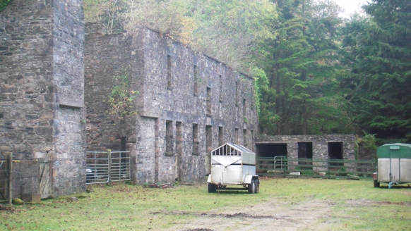 Dunlewy HouseOutbuilding · 2.2 mi
Explorer Tom Dunlewy House in Dunlewy Far is an outbuilding that thinks it’s the main event because it has such fancy stone work.…
 Catholic Church of the Sacred HeartChurch/chapel · 2.5 mi
Explorer Tom Catholic Church of the Sacred Heart stands between Errigal Mountain and Lough Nacung, with a round tower and a…
 Errigal Youth HostelHostel · 2.5 mi
Explorer Tom Errigal Youth Hostel in County Donegal is where dreams go to get squished under mattresses. It's cozy if you define…
 McGeady's BarPub · 2.6 mi
Explorer Tom McGeady’s Bar is sitting there looking suspiciously quiet in County Donegal, waiting for someone to ask if they’ve had…
 Páirc Naisiúnta Ghleann Bheatha - Glenveagh National ParkNature reserve · 4.3 mi
Explorer Tom Glenveagh National Park is Donegal giving you room to breathe on a grand scale: lough, bog, woodland and mountain all…
 Siúlóid an Chlocháin BhigOfficial walking route · 4.5 mi
Explorer Tom Siúlóid an Chlocháin Bhig has a name that may test your tongue and a route that rewards your feet. This Crolly loop…
 Cairn, LoughanurePublicly named cairn · 4.8 mi
Explorer Tom Cairn, Loughanure is a place where the name suggests a connection to water and perhaps a specific local story. I…
 Cairn, CronalaghtPublicly named cairn · 5.2 mi
Explorer Tom Cairn, Cronalaght is in a bitter feud with the rain because it keeps getting wet but refuses to acknowledge that it’s…
 Astelleen Burn WaterfallWaterfall · 6.3 mi
Explorer Tom Astelleen Burn Waterfall is the reward for carrying on beyond Glenveagh Castle when everyone else has decided the…
 Braade StrandBeach / strand · 7.1 mi
Explorer Tom Braade Strand does a lovely Donegal trick: it gives you a modest beach beside famous Carrickfinn, then opens a wide…
More mountains and hills in County Donegal · All of County Donegal

What do you know about this place?Tap to add a comment or ask a question