
Places near here
Photo credits
- Britishfinance, Wikimedia Commons · CC BY-SA 4.0
- Patrice78500, Wikimedia Commons · Public domain
- National Inventory of Architectural Heritage
- dalvenjah on Flickr, Wikimedia Commons · CC BY-SA 2.0
- Nigel Thompson, Geograph · CC BY-SA 2.0
- Kahuroa, Wikimedia Commons · Public domain
- Joseph Mischyshyn, Wikimedia Commons · CC BY-SA 2.0
- Dr. Charles Nelson, Wikimedia Commons · CC BY-SA 2.0
- dconvertini, Wikimedia Commons · CC BY-SA 4.0
 MucanachtMountain / peak · 1370 yd
Explorer Tom Mucanacht has been waiting since 1846 for a prophecy to come true, which was basically just a farmer promising to fix the gate. He never did, and now the mountain is just sulking on top of the Twelve Bens. Bring sandwiches, the gulls will thank you.
 Binn FraoighMountain / peak · 1.4 mi
Explorer Tom Binn Fraoigh is secretly proud of one specific potato it grew in the shadow, which has become a local legend among the farmers nearby. Best seen with a hangover and a sausage roll in your hand for comfort.
Booley hut in Addergoole (ballynahinch By.)Booley hut · 1.9 miExplorer Tom A booley hut in Addergoole tucked into blanket bog, probably older than your granddad’s bad decisions. It’s got walls that have seen more weather than most cities. Snap one quick photo, put your phone away, and actually look at the bog with your own eyes.
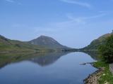 Binn GhuaireMountain / peak · 2.6 mi
Explorer Tom Diamond Hill glitters, but I have found no jeweller at the top. Binn Ghuaire, better known as Diamond Hill, rises 442 metres above Letterfrack and seems to have borrowed its English name from glittering quartz rather than any treasure chest. Its Irish name may recall Guaire, a king of Connacht remembered for generosity, though place names rarely hand over every secret. The hill was closed to climbing in 2002 after heavy erosion. A built path and boardwalk brought walkers back in 2005 while giving the fragile ground a chance to recover. I'd ask the quartz for a souvenir; it would give me the climb instead. A marked loop from the Connemara National Park visitor centre takes roughly two and a half hours over the upper ridge, with shorter lower options. Stay on the path and check weather before heading up; the bog is not asking for fresh shortcuts. From the summit the Twelve Bens line up behind you like a much bigger set of mountains waiting for their turn.
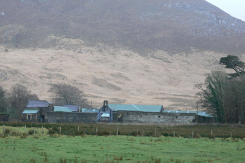 Kylemore Farm HouseFarmyard complex · 2.7 mi
Explorer Tom Kylemore Farm House in Addergoole has a local legend about a giant who used to use the gateway as a doorstop, which is why the bellcote looks so suspiciously large for a normal farm. It’s got that contrast between rubble stone and yellow brick dressings that makes it look like a fancy landmark on the road to Clifden. Just listen out for the giant!
 Kylemore AbbeyBoathouse · 2.9 mi
Explorer Tom Kylemore Abbey's boathouse is hiding on a hillock and thinks tourists from Dublin are all a bit over-caffeinated. Its barrel-vaulted roof is technically impressive, but it keeps the red-brick detailing subtle because it likes to be understated. It probably rolls its eyes when someone asks if they can touch the boat.
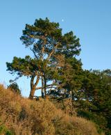 Monterey Pine3.0 mi
Explorer Tom Monterey Pine in County Galway once saw a fox try to climb it but get stuck halfway up because the branches were too spiky. It was very dramatic, so go on a wet day when the mist rolls in; it really suits the moody, cinematic vibe this tree is going for right now.
 CrannogIslet · 3.2 mi
Explorer Tom Crannog has strict rules for visitors: no talking louder than a whisper, no touching the ancient wood, and absolutely no bringing in modern coffee machines because they smell like sin. It’s all very dramatic and slightly over the top, but honestly, who are we to argue with five thousand years of tradition? Perfect place to be dramatically windswept.
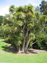 Cabbage tree3.4 mi
Explorer Tom Cabbage tree in County Galway looks like it’s waiting for a bishop who refused to visit because the leaves were too leafy. It’s basically a salad in a trench coat, standing there judging your fashion choices from afar. Hum something sad nearby, it adds atmosphere.
 Fairy fort / stone ringfort in BallynahinchFairy fort / stone ringfort · 3.6 mi
Explorer Tom Fairy fort in Ballynahinch had a feud with the next village over who got to keep the bigger boulder. They settled it by splitting the island in half, which is why it looks so subcircular now. The castle on top is just the winner’s trophy sitting on the loser’s head. A good place to forget your phone for ten minutes.
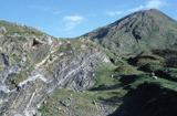 Connemara National ParkNational park · 3.6 mi
Explorer Tom I came to Connemara National Park ready to admire the mountains and got distracted by plants that eat their dinner. Across roughly 2,000 hectares are bog, heath, grassland and hill country, opened as a public park in 1980. Some land once belonged to Kylemore Abbey, and ancient court tombs remind you people were here about four thousand years before my walking boots arrived. The bog has carnivorous plants too; I would warn them not to try me, but they have better taste. Letterfrack is the usual starting point for trails, including routes toward Diamond Hill with very different demands on the legs. Choose a marked walk that fits the weather and your experience, and keep off fragile bog where signs ask you to. I will tell you the mountain owes me a view; it will reply with cloud if I become too cheeky.
 Pine IslandIslet · 5.0 mi
Explorer Tom Pine Island was once an old jail for two people who probably argued about nothing. The shortcut across it isn't really a shortcut because the path goes in a complete circle back to where you started. Visit, then text me what you think. I'll pretend to read it.
More mountains and hills in County Galway · All of County Galway

What do you know about this place?Tap to add a comment or ask a question