
Places near here
Photo credits
- Kmcnamee, Wikimedia Commons · CC BY-SA 4.0
- National Inventory of Architectural Heritage
- Reading Tom, Wikimedia Commons · CC BY 2.0
- Laurel Lodged, Wikimedia Commons · CC0
- Algirdas at Lithuanian Wikipedia, Wikimedia Commons · Public domain
- Miguel Angel Masegosa Martínez, Wikimedia Commons · CC BY 2.0
Explorer Tom Legan’s Embanked enclosure had a bishop who refused to visit because he didn't like the view of Kiglass Lough. The…
St Patricks WellHoly well · 1410 ydExplorer Tom St Patricks Well in Kilbeg is marked on old maps as being in a water-logged fosse, which sounds like a terrible place…
 Kilglass Gaels GAA pitchGAA ground · 1.4 miGoat IslandIslet · 2.2 mi
Explorer Tom Goat Island claims the local bishop refused to visit because he was afraid the goats would eat his vestments during the…
Garrymond IslandIslet · 2.7 miExplorer Tom Garrymond Island would say in a job interview that it is extremely reliable because it has never moved an inch in over…
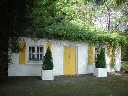 Mount AshleighGate lodge · 3.0 mi
Explorer Tom Mount Ashleigh gate lodge in Glebe would survive a zombie attack simply by closing its gates and hoping they forget…
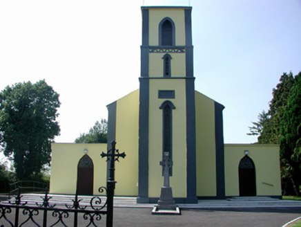 Catholic Church of Our Lady of Mount CarmelChurch/chapel · 3.1 mi
Explorer Tom Our Lady of Mount Carmel in Roosky has got the altar on the wrong end of the building, apparently. The map makers were…
 Cavan & Leitrim RailwayMuseum · 4.5 mi
Explorer Tom The Cavan and Leitrim Railway at Dromod has a small train with a big talent for making grown adults grin before it has…
 Strokestown ParkHeritage attraction · 4.6 mi
Explorer Tom Strokestown Park in Roscommon places a grand country house beside the National Famine Museum, asking visitors to see…
Kilmore GAAGAA ground · 4.7 mi Pedunculate Oak4.8 mi
Explorer Tom Pedunculate Oak in County Roscommon is haunted by a ghost who is far too lazy to actually haunt it, so it just sits…
 Sweet Chestnut4.9 mi
Explorer Tom Sweet Chestnut in County Roscommon decided to give up its acorns for Lent this year because it felt they were too heavy…
More archaeology and monuments in County Roscommon · All of County Roscommon

What do you know about this place?Tap to add a comment or ask a question