
Places near here
Photo credits
- National Inventory of Architectural Heritage
- Graham Horn / Geograph Britain and Ireland, commons.wikimedia.org
- Graham Horn, Geograph · Creative Commons Attribution-ShareAlike 2.0
- Andreas F. Borchert, Wikimedia Commons · CC BY-SA 4.0
- Sportsfile, via Connaught Telegraph; individual photographer not named, www.con-telegraph.ie
- Maker named on the Wikimedia Commons picture page · Public domain
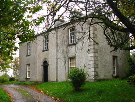 GreenhillsFarm house · 1.4 mi
Explorer Tom Greenhills in Claggarnagh West is showing off its pretty 'cobweb' fanlight like it just won an award for best window…
 bridge1.5 mi
Explorer Tom Bridge in Cushinkeel thinks it’s too posh for the dirt road, so it just sits there judging your boots. It’s got that…
 Islandeady, Islandeady GAAGAA ground · 1.7 mi
 Graveyard2.0 mi
Explorer Tom Graveyard in Islandeady has changed its name so many times it’s forgotten what it even was before. The church is a…
Carney's Cottage 1863Memorial · 3.3 miExplorer Tom Carney's Cottage 1863 was saved by a hero nobody remembers because he was too busy fixing the roof and not taking…
 Round Tower3.4 mi
Explorer Tom Round Tower in Aghagower claims St Patrick consecrated it, but I think he just dropped his keys here. The name probably…
Famine MemorialMemorial · 3.4 miExplorer Tom Famine Memorial is bragging about surviving storms that would have flattened my tent in seconds, all while looking a…
Cock IslandWood · 3.6 miExplorer Tom Cock Island is officially a wood on paper, but let’s be real, it’s an island that got lost in the filing system. It’s…
 Naomh Padraig Cathair Na Mairt, Westport, Westport GAAGAA ground · 4.3 miBrockagh Castle in ruinsCastle, tower house · 4.9 mi
Explorer Tom Brockagh Castle in ruins is letting the seagulls use its roof as a free parking zone for their gossip sessions. They’re…
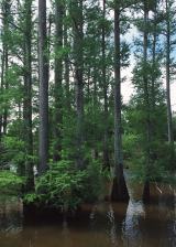 Baldcypress4.9 mi
Explorer Tom Baldcypress has a secret talent for looking like it's judging your life choices from across the field. It drops its…
Pirate QueenHeritage attraction · 5.0 miExplorer Tom Pirate Queen is a heritage attraction where a local priest allegedly lost a bet over who could shout louder across the…
More archaeology and monuments in County Mayo · All of County Mayo

What do you know about this place?Tap to add a comment or ask a question