What is recorded here
Achnammean is a head dyke in Highland, Scotland.
Places near here
Picture notes
- Mick Crawley, Wikimedia Commons · CC BY-SA 2.0
- Graeme Smith, Wikimedia Commons · CC BY-SA 2.0
- Computer-made picture. It does not show this monument.
- Peter Moore, Wikimedia Commons · CC BY-SA 2.0
- Jonathan Billinger, Wikimedia Commons · CC BY-SA 2.0
- Computer-made picture. It does not show this mountain top.
- Andrew Tryon, Wikimedia Commons · CC BY-SA 2.0
- Alasdair MacDonald, Wikimedia Commons · CC BY-SA 2.0
- Computer-made picture. It does not show this walking route.
- John Lucas, Wikimedia Commons · CC BY-SA 2.0
 Cnoc An Torra MhoirHut Circle (prehistoric) · 600 yd
 Druim Torr Nan CliabhCairnfield, Hut Circle (prehistoric) · 865 yd
 Coich, BrochArchaeological place · 1012 ydComputer-made picture
 Coich BurnBroch (iron Age) · 1026 ydComputer-made picture
 AchnameanField System (prehistoric), Hut Circle(s) (prehistoric) · 1033 ydComputer-made picture
 Strath BroraFarmstead · 1242 yd
 Balnacoil LodgeBuilding · 1.4 mi
 Meall na h-AmaiteMountain / peak · 2.1 miComputer-made picture
 Cnoc an Lochan DuigheMountain / peak · 2.3 mi
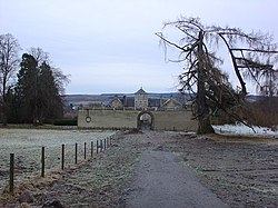 Battle of Alltan-BeathBattle · 3.5 mi
 Morness - Mill - Little RogartWalking route · 5.5 miComputer-made picture
 Rogart, CemeteryCemetery (20th Century) · 5.5 mi
More historic places in Highland · All of Highland

What do you know about this place?Tap to add a comment or ask a question