
What is recorded here
Achinael is a head dyke in Highland, Scotland.
From the Historic Environment Scotland record 91313
The historic-place record does not grant public access. Check current conditions and ownership before entering land or a building.
Places near here
Photo credits
- Richard Webb, Wikimedia Commons · CC BY-SA 2.0
- Steven Brown, Wikimedia Commons · CC BY-SA 2.0
- Andrew Tryon, Wikimedia Commons · CC BY-SA 2.0
- Gordon Hatton, Wikimedia Commons · CC BY-SA 2.0
- Chris Heaton, Wikimedia Commons · CC BY-SA 2.0
- Richard Sutcliffe, Wikimedia Commons · CC BY-SA 2.0
- JThomas, Wikimedia Commons · CC BY-SA 2.0
- John Lucas, Wikimedia Commons · CC BY-SA 2.0
- paul c, Wikimedia Commons · CC BY-SA 2.0
 Creag An AmalaidhHut Circle(s) (prehistoric) · 307 yd
 Creag An AmalaidhField System, Hut Circle(s) (prehistoric) · 308 yd
 Torboll Burn, Salmon LadderFish Ladder (19th Century) - (20th Century) · 1070 yd
 TorbollFarmstead · 1153 yd
 Cnoc OdharMountain / peak · 1468 yd
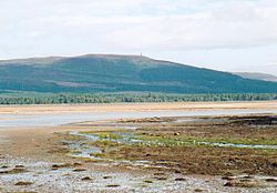 Battle of Skibo and StrathfleetBattle · 1.7 mi
 Meall Loch LaoighMountain / peak · 1.7 mi
 Creag BheagCliff · 2.0 mi
 Skelbo Wood BrochArchaeological place · 2.8 mi
 Skelbo CastleCastle (14th Century), House (17th Century), Motte and Bailey (medieval) · 3.0 mi
.jpg/250px-Rogart_War_Memorial_(geograph_6169889).jpg "Photo: John Lucas, Wikimedia Commons · CC BY-SA 2.0") Rogart War MemorialMemorial · 3.0 mi
Rogart War MemorialMemorial · 3.0 mi Loch Fleet National Nature ReserveNature reserve · 3.0 mi
More historic places in Highland · All of Highland
What do you know about this place?