
What is recorded here
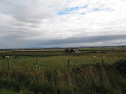
Achies East is a broch in Highland, Scotland.
Places near here
Picture notes
- Computer-made picture. It does not show this monument.
- Alan Reid, Wikimedia Commons · CC BY-SA 2.0
- Phil Williams, Wikimedia Commons · CC BY-SA 2.0
- David Bremner, Wikimedia Commons · CC BY-SA 2.0
- Computer-made picture. It does not show this garden.
- Jim Bain, Wikimedia Commons · CC BY-SA 2.0
 Achies East BrochArchaeological place · 5 ydComputer-made picture
 AchlureHut Circle(s) (later Prehistoric) (possible) · 435 ydComputer-made picture
 BenachieCairn (prehistoric) · 516 ydComputer-made picture
 Achanarras, the SheanCairn (bronze Age) · 727 ydComputer-made picture
 Torr BuieWell · 732 ydComputer-made picture
 Achanarras HillField Boundary(s) (post Medieval) · 741 ydComputer-made picture
 AchaloneFarmstead · 1507 yd
 Harpsdale MainsCottage(s), Farmhouse, Farmstead · 1650 yd
 Achlachan MossForest · 1.2 mi
 Battle of HarpsdaleBattle · 1.5 mi
 Dale House, walled gardenGarden · 2.3 miComputer-made picture
 Dirlot CastleCastle (medieval) · 4.4 mi
More archaeology and monuments in Highland · All of Highland

What do you know about this place?Tap to add a comment or ask a question