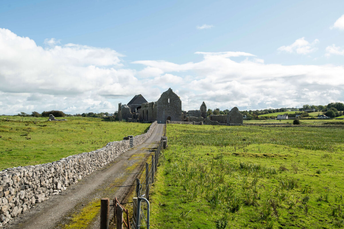
What is recorded here
Abbey (Site of) is a church in Kilcummin, County Sligo, Ireland. It stood on flat ground within the north half of Kilcummin graveyard, where considerable fragments remained until the 1880s before being reused as grave markers. A window base and two jambstones are still visible, while a nearby friary and bullaun stone mark the broader ecclesiastical landscape.
In pasture, on flat ground and on the E side of a road, named 'Stirabout Road' on the 1838 OS 6-inch map. Within the N half of Kilcummin graveyard (SL031-005002-) and also within a possible ecclesiastical enclosure (SL031-005003-). No trace is evident of the building indicated on the 1838 OS 6-inch map as a rectangular structure (c. 20m E-W; c. 10m N-S) and named 'Abbey'. It was recorded in 1836 as 'an old abbey in ruins in Cill Cuimín' (OSL, 389). According to local information, 'considerable fragments' of the church remained up to the 1880s but these were all reused as grave-markers (SL031-005004-) (O'Rorke [1889], vol. 2, 130-31). The base of a window and two jambstones are still evident in the graveyard (pers. comm. M. A. Timoney). Part of the enclosing vallum may be extant (SL031-005003-). According to Gwynn and Hadcock (1970, 390), Kilcummin was founded 'perhaps by St. Caeman or by St. Coemgen'. The site of a friary (SL031-006001-) and a bullaun stone (SL031-006002-) are c. 60m and c. 130m to the NE respectively. An associated holy well, 'Tobar Cuimín' (SL031-005005-), remains unlocated.
The above description is derived from the published 'Archaeological Inventory of County Sligo' compiled by Ursula Egan, Elizabeth Byrne, Mary Sleeman with Sheila Ronan and Connie Murphy (Dublin Stationery Office, 2005).
Date of upload: 18 January 2008
The site of Abbey at Kilcummin is associated with an early Christian church, likely founded in the medieval period, and may have been dedicated to a local saint. Its location within a possible ecclesiastical enclosure suggests it was part of a significant religious settlement, though specific builders and dates remain unidentified.
The monument record does not grant public access. Check the route and ask the landowner before entering private land.
- What survives
- Recorded monument
Places near here
 Ecclesiastical enclosure in KilcumminEcclesiastical enclosure · 17 yd
 FriaryReligious house, Franciscan Third Order Regular · 74 yd
 IndicatedFairy fort / stone ringfort · 703 yd
 Carrowmore National Schoolschool · 2.4 mi
 KnocknasheeMountain / peak · 2.9 mi
 The Turf Stack RockNamed rock · 2.9 mi
 Muckelty HillMountain / peak · 3.2 mi
 Tawnyart WoodWood · 3.5 mi
 New WoodWood · 3.7 mi
 CastleCastle, unclassified · 4.1 mi
 Ballyara Castle (in Ruins)Castle, unclassified · 4.3 mi
 Mass RockNamed rock · 4.4 mi
Other information
Photo: Credit not shown in the picture search · Rights wording not checked; contact us if this picture should be removed