What is recorded here
South Abbey still stands in Youghal, but the windmill that turned beside it has vanished into legend. Some memories place it east of the church, others north on the hill now called Windmill Lane, and others again at the water's edge where the sea wind never slept. Whatever the truth, the mill was no ordinary building. It wore a revolving cap and dragged a weighted wheel along the ground to face the storm, forcing the sky itself to help grind the town's bread.
According to Zajac et al. (1995, 108), a windmill is depicted on the 17th-century Pacata Hibernia map to the E of South Abbey (CO067-028001-), adjacent to the waterfront and S of the medieval town of Youghal (CO067-029001-). Various locations are suggested for this windmill. Zajac et al. (ibid.) state that Burke's 17th-century painting of Youghal places the windmill to the N of South Abbey, in the general area of the hill currently referred to as Windmill Lane (Harbison 1973, 67). According to Brady (1863, 412), the windmill was located by the seaside. Brady (ibid.) describes the windmill as having 'gridded sails and a revolving cap which was guided by an arm with a wheel on the end of it which was rolled along the ground.' The precise location of this windmill is not known. (Zajac et al. 1995, 108)
Compiled by: Archaeological Survey Unit, UCC.
Date of upload: 20 January 2010
The monument record does not grant public access. Check the route and ask the landowner before entering private land.
- What survives
- Recorded monument
Places near here
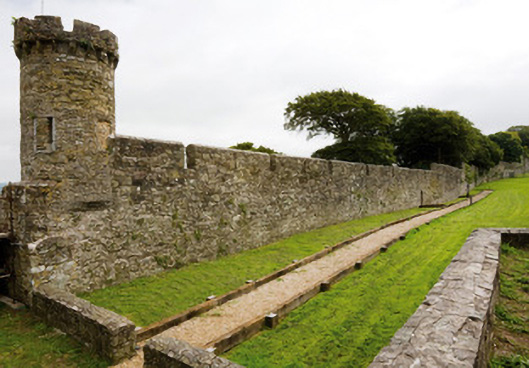 town/city wallstown/city walls · 154 yd
 Town WallHeritage attraction · 176 yd
 G YdGraveyard · 202 yd
 Church in Youghal-LandsChurch · 272 yd
 Collegiate Church of Saint MaryHeritage attraction · 273 yd
 IndicatedGraveyard · 275 yd
 Emmet PlaceMemorial · 290 yd
 Our Lady's CollegeMemorial · 307 yd
 Priory Court Car ParkVisitor information · 307 yd
 English hollyEnglish holly · 339 yd
 European YewEuropean Yew · 353 yd
 Youghal Heritage WalkWalking route · 415 yd