What is recorded here
A vertical water mill indicated and annotated, 'a mill', on the Down Survey (1655-6) barony map of Shillelogher, County Kilkenny (Hibernia Regnum, courtesy of Trinity College Dublin). It is shown on the N bank of the Kings River SE of Ennisnag Castle (KK027-018----) and E of a bridge (KK027-065----) also depicted on the Down Survey map. A flour mill is indicated on the 1st (1839) ed. OS 6-inch map on a millrace which branches off the Kings River, c. 280m NE of Ennisnag Bridge, and rejoins it c. 860m downstream. By the 1948 ed. the mill is indicated as 'Corn Mill (Disused)'. The mill depicted on the Down Survey map may be located on or near this later mill, however, the precise location of the mill is currently unknown.
See attached:
KK027-066----_01 extract from the Down Survey (1655-6) barony map of Shillelogher, Co. Kilkenny (Hibernia Regnum, courtesy of Trinity College Dublin)
Compiled by: Jean Farrelly
Date of upload: 23 May 2023
The monument record does not grant public access. Check the route and ask the landowner before entering private land.
- What survives
- Recorded monument
Places near here
 Enclosure in EnnisnagEnclosure · 324 yd
 Coortaur Castle (in ruins)Castle, unclassified · 906 yd
 TobermogueHoly well · 960 yd
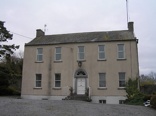 Ennisnag Housemiller's house · 1176 yd
 Saint Peter's Church (Ennisnag)church/chapel · 1182 yd
 Cats WoodWood · 1687 yd
 Ballyda Holy WellSpring · 1.1 mi
 RIC BarracksMemorial · 1.2 mi
 Petty Sessions Courthouse 1839Memorial · 1.2 mi
 Welsh'sForest · 1.6 mi
 Annamult Castle (in ruins)Castle, tower house · 1.6 mi
 Kells Priory Mill MuseumMuseum · 1.8 mi