What is recorded here
TUAM is a historic Galway town where St Jarlath founded a monastery in the early 6th century and later became one of Ireland’s four great church centres. The O'Conors made it a royal and trading place, building a castle in 1161 and helping the town grow around the River Nanny fording point. Churches, crosses, mills and palace remains still mark the ridge, while the surrounding bogs keep the old boundary between settlement and wilderness.
On a steep rise on S bank of the River Nanny overlooking a fording point, the site is flanked to E and W by extensive bogs. St Jarlath founded a monastery at 'Tuaim-da-ghualann' in the early 6th C (Gwynn and Hadcock 1970, 98). Under the patronage of the Kings of Connacht (O'Conors) in the 11th-12th C, the settlement expanded rapidly and was named as one of four metropolitan sees at the Synod of Kells in 1152 (Killanin and Duignan 1967, 443-5; Stalley 1981, 179-80; Bradley and Dunne 1992, 166-8). The O'Conors built a 'castle' (GA029-173----: see also GA029-199003-) here in 1161 and by the first half of the 13th C documentary sources are referring to 'the suburbs' and 'houses of the … town' as well as the granting of a licence for an annual fair (see GA029-178----, GA029-184001-; Lewis 1837, Vol. 2, 646). The numerous early Christian and medieval ecclesiastical remains comprise: (a) the chancel of a Romanesque church (GA029-179001-) and (b) a 14th-C 'Synod Hall' (GA029-179002-), both now incorporated into the gothic revival cathedral of St Mary; (c) 100m to NW lies the site of the 'Abbey of the Holy Trinity' (GA029-178----); (d) 150m to NW, in High St., is a probable early ecclesiastical enclosure (GA029-180003-) within which stands 'Temple Jarlath' (GA029-180001-); (e) 550m to NE, in Bishop St., is a second enclosure (GA029-068001-) within which stood 'Templenascreen' (GA029-068002-); (f) 325m to E, in Circular Rd, lies the site of 'St. John's Priory' (GA029-184001-); (g) 1.1km to SE, on the Athenry Rd, is a third enclosure (GA043-080001-) at Toberjarlath; and (h) c. 200m to S, in the Vicar St. area, stood St Brigid's Chapel (GA029-183----). The site of the shambles (GA029-199006-) is known and fragments of four high crosses (GA029-179006-, GA029-179007, GA029-179004-, GA029-184002-) survive. The post-medieval remains include an 18th-C bishop's palace in Bishop St (Bence-Jones 1978, 276), a pre-Emancipation chapel (GA029-181----), a vertical watermill (GA029-182----), a windmill (GA029-191----) and the 'Chair of Tuam' (GA029-172----). (Kelly 1901, 1904, 1906, 1908; Ó Murchú 1970)
The above description is derived from the published 'Archaeological Inventory of County Galway Vol. II - North Galway'. Compiled by Olive Alcock, Kathy de hÓra and Paul Gosling (Dublin: Stationery Office, 1999).
Date of upload: 05 August 2010
The monument record does not grant public access. Check the route and ask the landowner before entering private land.
- What survives
- Recorded monument
Places near here
 Tuam Town Halltown/county hall · 30 yd
 CastleCastle, unclassified · 49 yd
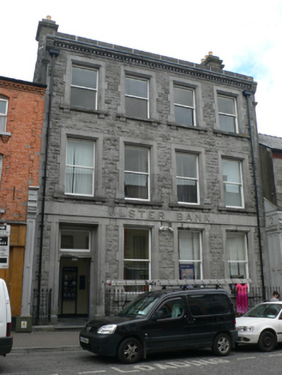 Ulster Bankbank/financial institution · 52 yd
 Cross in Townparks (2nd Division - Tuam)Cross · 120 yd
 CrossCross, High cross · 162 yd
 Castle (in ruins)Castle, tower house · 2.1 mi
 European ashEuropean ash · 2.4 mi
 Mass RockNamed rock · 3.5 mi
 KnockmaaWood · 5.2 mi
 Kilcoona Round TowerHeritage attraction · 9.0 mi
 Ballinduff BayBay · 11 mi
 Oileán an BhreathnaighIslet · 14 mi