
What is recorded here
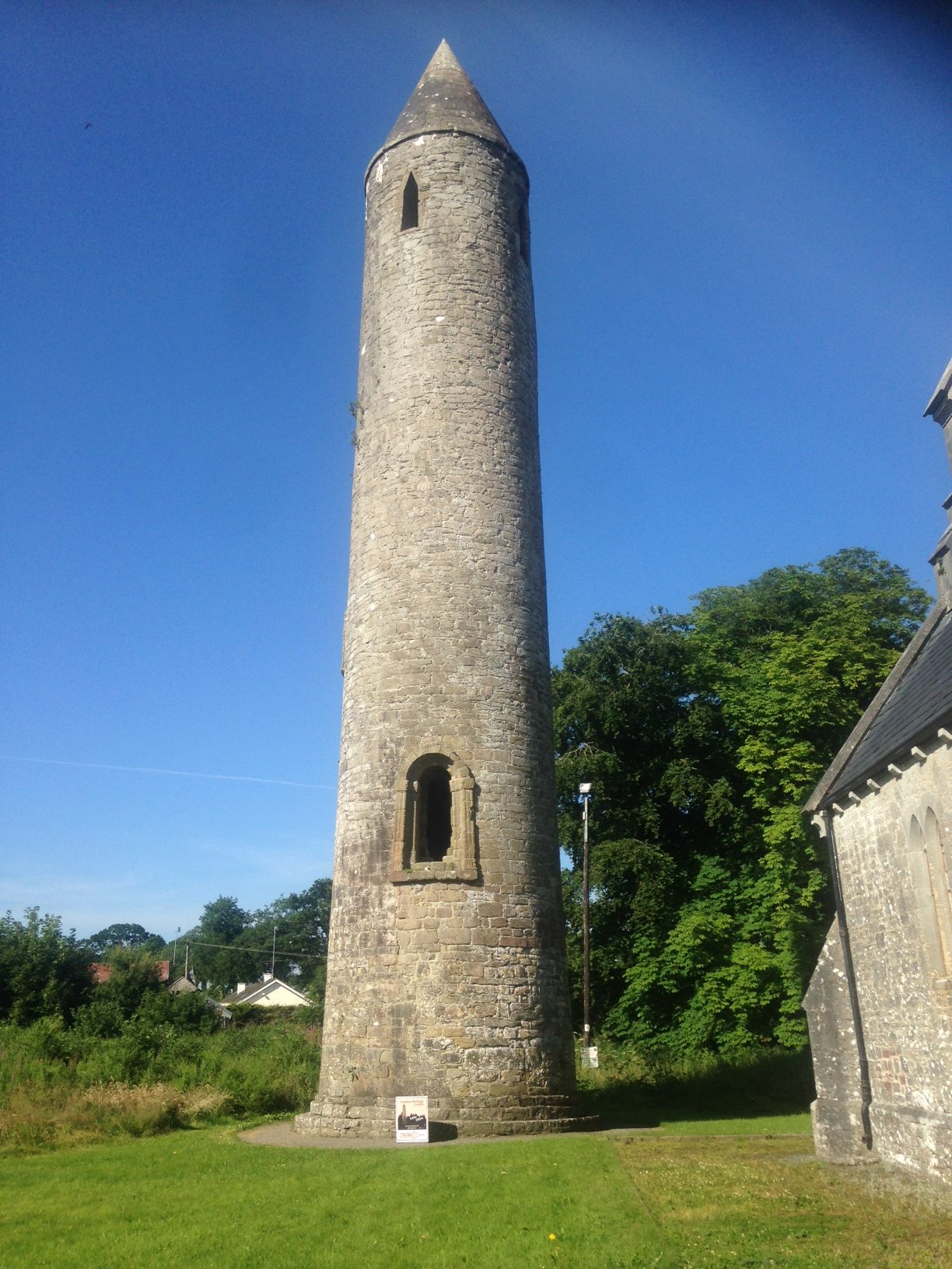
You need a camera, not a ladder. Climb the E face to the first floor doorway, drop to the N base, and find the bearded man bending his legs behind his ears while his hands pull his cheeks apart. The round tower stands in County Laois with that ridiculous carve at its entrance, as if God had lost his patience with solemn churches and made a joke instead.
National Monument in state ownership no. 114. Round tower (LA018-031005-) entered through a Romanesque doorway with four orders of sandstone blocks at first floor level in the E face. The internal arch of the doorway is decorated with lozenge patterns or chevrons while the doorway is decorated with typical Romanesque features such as human faces on the angles of the capitals. At the base of the doorway on the N side on the third order there appears to be a possible male exhibitionist figure in an acrobatic position with legs bent behind the ears and the hands appear to be pulling the cheeks apart to reveal the anus. The figure has a bearded face with hands beneath the chin either pulling at his beard or pulling the cheeks of his backside apart to reveal his anus.
The above description is derived from the published 'Archaeological Inventory of County Laois' (Dublin Stationery Office, 1995) compiled by P. David Sweetman, Olive Alcock and Bernie Moran. In certain instances the entries have been revised and updated in the light of recent research.
Images of possible exhibitionist figure uploaded courtesy of Neil Jackman.
Compiled by: Caimin O'Brien
Date of upload: 28 October 2015
The monument record does not grant public access. Check the route and ask the landowner before entering private land.
- What survives
- Recorded monument
Places near here
 Timahoe Heritage Centrechurch/chapel · 22 yd
 Timahoe Abbey (in ruins)Ecclesiastical site · 25 yd
 Timahoe AbbeyCastle, tower house · 38 yd
 Timahoe Church and Round TowerVisitor information · 49 yd
 Saint Michael's Catholic Churchchurch/chapel · 156 yd
 Enclosure in TimahoeEnclosure · 821 yd
 CastleCastle, motte and bailey · 1244 yd
 Rock of CashelMountain / peak · 3.8 mi
 European BeechEuropean Beech · 4.3 mi
 Mass Rock WalkWalking route · 4.4 mi
 Oughaval Wood MapVisitor information · 4.4 mi
 CEMETERYGraveyard · 4.4 mi
Other information
Photo: John Bedlington · CC BY-SA 2.0