What is recorded here
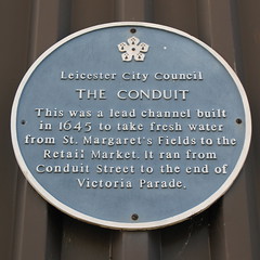
This blue commemorative plaque records: The Conduit. This was a lead channel built in 1645 to take fresh water from St. Margaret's Fields to the Retail Market. It ran from Conduit Street to the end of Victoria Parade. Recorded plaque organisation: Leicester City Council.
The Conduit in Leicester, established in 1645, was a significant early public water supply system that brought fresh water from St. Margaret's Fields to the Retail Market, improving public health and commerce in the area.
A plaque record does not grant entry to a building or private land. View it from a public place unless permission is clearly given.
Places near here
 Porte Cochere, Pedestrian Loggia and Octagonal Turret Forming Frontage to Leicester StationListed building · 218 yd
 Two K6 Telephone Kiosks Outside London Road StationListed building · 240 yd
 Thomas CookMemorial · 258 yd
 Thomas Cook Statue, LeicesterMonument or public art · 259 yd
 City Police HeadquartersVisitor information · 362 yd
 De Montfort SquareVisitor information · 415 yd
 TranquilityMemorial · 456 yd
 The Clothier sculpture, New Walk, LeicesterPublic sculpture · 458 yd
 Arch of RemembranceMonument · 988 yd
 Greyfriars, LeicesterScheduled monument · 1084 yd
 Leicester Castle MotteArchaeological place · 1364 yd
 55 and 57, London Road, LeicesterListed building · 251 yd
Other information
Photo: Helen Wells · CC BY 2.0