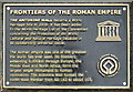
What is recorded here
This black commemorative plaque records: Frontiers of the Roman Empire. The Antonine Wall became a World Heritage Site in 2008. It has been added to the World Heritage List of the Convention concerning the Protection of the World Cultural and Natural Heritage because of its outstanding universal value. The Roman empire was one of the greatest the world has ever seen. Its frontiers, extending 5,000km through Europe, the Middle East and North Africa, form the largest single monument to Roman civilisation. The Antonine Wall formed the north-west frontier from AD 142 to about 165. Recorded plaque organisation: UNESCO World Heritage.
The Antonine Wall was a fortification built by the Romans across what is now Scotland, marking the northernmost boundary of the Roman Empire from AD 142 to about 165. It became a World Heritage Site in 2008 due to its outstanding universal value as part of the frontiers of the Roman Empire.
A plaque record does not grant entry to a building or private land. View it from a public place unless permission is clearly given.
Places near here
 Bo'ness, Kinneil HouseCountry House (16th Century), Tower House (15th Century) · 210 yd
 James Watt CottageRuins · 210 yd
 Kinneil HouseSquare Enclosure (roman) · 238 yd
 Kinneil Roman FortletArchaeological place · 331 yd
 Kinneil MuseumMuseum · 346 yd
 Bo'ness, Kinneil, DeanDetached House (19th Century), Dower House (19th Century) · 723 yd
 Bo'mains Meadow Wildlife ReserveVisitor information · 1235 yd
 Kinneil Nature ReserveNature reserve · 1328 yd
 Bo'mains MeadowNature reserve · 1377 yd
 Kinneil ForeshoreVisitor information · 1410 yd
 Bo'ness War MemorialMemorial · 1.2 mi
 Bo'ness Mining MemorialMemorial · 1.3 mi
Other information
Photo: M J Richardson on Geograph · CC BY-SA 2.0