What is recorded here
A small rectangular building (int. dims. c. 9m E-W; c. 6m N-S) locally known as 'Teampaill Ceallaigh' and associated with St Killian. Situated on a raised mound within an early 19th-century graveyard. Remaining features of building include outline of a much-ruined window in E wall, a blocked-up doorway at the centre of S wall and a chimney and narrow fireplace built into W wall. Davies (1948, 115) was of the opinion that this is not an ecclesiastical building and if it is, it must be post-Reformation. Original location of Mullagh ogham stone (CV040-047----). (CUCAP BGQ 72)
The above description is derived from the published 'Archaeological Inventory of County Cavan' (Dublin: Stationery Office, 1995). In certain instances the entries have been revised and updated in the light of recent research.
Date of upload/revision: 22 December 2008
Templekelly, Mullagh is a small rectangular church associated with St Killian, built on a raised mound within an early 19th-century graveyard; its construction likely dates to the early medieval period and reflects a simple monastic or parish church tradition.
The monument record does not grant public access. Check the route and ask the landowner before entering private land.
- What survives
- Recorded monument
Places near here
 Grave YardGraveyard · 22 yd
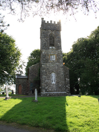 Mullagh Church of Ireland Churchchurch/chapel · 67 yd
 Sally IslandIslet · 390 yd
 Green IslandPromontory fort, inland · 509 yd
 Crow IslandIslet · 621 yd
 St Killian's Roman Catholic Churchchurch/chapel · 654 yd
 Cloghballybeg ForestForest · 970 yd
 CastleCastle, unclassified · 1657 yd
 Cloghbally LowerMountain / peak · 1.2 mi
 Sit of Old CastleCastle, unclassified · 1.6 mi
 Cornaglare or PalmiraMountain / peak · 2.1 mi
.jpg?width=1280) Ogham stone (present location) in MullaghOgham stone (present location) · 581 yd
Ogham stone (present location) in MullaghOgham stone (present location) · 581 yd