
What is recorded here
Situated on a S-N peninsula (dims c. 170m N-S; c. 30-40m E-W) which juts N from the W shore of Lough Allen and which might at one time have been an island close to the shore. There are no known medieval references to this church, although it may have been a possession of St Mary’s convent at Adcarn (RO006-103003-). Traditionally, this is thought to be the site of a nunnery known as Tarmon Abbey (McParlan 1802, 103), and in the 1830s John O’Donovan recorded the name as Teampull na gCailleachadh Dubha – Church of the black-clad old women (nuns) (Herity 2012, 420), and it is recorded on the OS 6-inch maps as ‘Temple na galliagh doo’. This area is described as church land under the names Ballea, Derricknawa, Carragha, Largavrill, Aghamore, Attnagarow and Taronymore, on the Down Survey (1656-8) map of Inishmagrath parish, and while most of these names are now unknown the land may have belonged to this church rather than the church (LE020-003001-), c. 1.3km north along the lake-shore. For the Down Survey map see this web-page accessed on 16/12/2016: http://downsurvey.tcd.ie/down-survey-maps.php#bm=Drumaheir&c=Leitrim&p=Inishmacra
The church is an overgrown rectangular mortared limestone structure (ext. dims 15.6m E-W; 6m N-S) of which most of the N, E and the E part of S walls survive (H 1-4m; Wth 1.05m), together with cairn material. The W side of a window embrasure towards the E end of the S wall is evident but Davies (ITA Survey 1943) noted in addition that there was an E window and a S doorway, although no diagnostic features were visible. There is no evidence of any other structures; nor is there evidence of an enclosure or of burial.
The above description is derived from 'The Archaeological Inventory of County Leitrim' compiled by Michael J. Moore (Dublin: Stationery Office, 2003). In certain instances the entries have been revised and updated in the light of recent research.
Compiled and revised by: Michael Moore
Date of revised upload: 16 December 2016
The monument record does not grant public access. Check the route and ask the landowner before entering private land.
- What survives
- Recorded monument
Places near here
 Penal Mass station in TawnycorraghPenal Mass station · 949 yd
 Saint Patricks ChurchRuins · 1448 yd
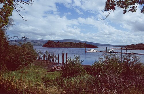 Lough AllenLarge freshwater lake · 1.2 mi
 GubcormonganHeadland · 1.3 mi
 Sweat Ho. (Disused)Sweathouse · 1.3 mi
 Long IslandIslet · 1.6 mi
 Round IslandIslet · 1.6 mi
 IndicatedFairy fort / ringfort · 1.9 mi
 Scardan WaterfallWaterfall · 2.5 mi
 European ashEuropean ash · 2.5 mi
 Black PoplarBlack Poplar · 2.5 mi
 Arigna Mining ExperienceMuseum · 3.1 mi
Other information
Photo: Credit not shown in the picture search · Rights wording not checked; contact us if this picture should be removed