What is recorded here
This possible structure, identified as Structure 3, was one of three located in the very exposed central section of Cutting 1; see also Structure 4 (GA110-039018-) and Structure 6 (GA110-039019-). Like the latter structure, this example consisted of a stone-lined pit or post-hole (0.85m by 1.15m; D up to 0.3m) that may originally have supported a roof. A possible associated spread of dispersed rubble lay to its N and a small paved area lay to its NE. The pit was irregular in outline but may originally have been five-sided. Two substantial set stones and a number of smaller blocks remained in situ. A third displaced block probably originally lined the E side. A few scraps of organic refuse were found in the backfill. The dispersed rubble to the N may have been part of an enclosing element such as a wall or rubble bank. However, if that was the case the feature appeared to have been extensively robbed out. No trace of the floor survived. A radiocarbon date for the overlying horizon yielded a radiocarbon date of 900-770 cal. BC; this provided a very broad terminus post quem for the structure (Cotter 2012, vol. 1, 335-7, 357) and while it is likely to be of prehistoric date, it is not necessarily of Late Bronze Age date (ibid., vol. 2, 246-8).
Compiled by: Olive Alcock
Date of upload: 23 June 2020
The monument record does not grant public access. Check the route and ask the landowner before entering private land.
- What survives
- Recorded monument
Places near here
 DunaengusCliff-edge fort · 14 yd
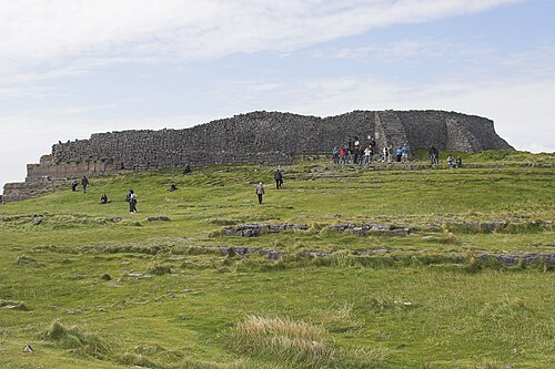 Dún AonghasaNature reserve · 48 yd
 Not locatedStructure · 67 yd
 Kilmurvey BeachBeach / strand · 321 yd
 TemplenaneeveChurch · 953 yd
 IndicatedChurch · 1399 yd
 Castle (in ruins)Castle, unclassified · 1.6 mi
 ÁrainnIsland · 1.6 mi
 An CharcairMountain / peak · 2.0 mi
 Seal Colony LookoutViewpoint · 2.4 mi
 An tOileán ThiarIslet · 3.5 mi
 Trá na mBuailte (Beach of the Booly)Beach / strand · 4.0 mi