What is recorded here
This possible structure, identified as Structure 6, was one of three located in the very exposed central section of Cutting 1; see also Structure 3 (GA110-039017-) and Structure 4 (GA110-039018-). This example, like Structure 3, consisted of a substantial stone-lined post-hole, which may have supported a roof. A zone of paving lay to its SW. The post-hole (0.6m by 0.58m; D up to 0.35m) was pentagonal in plan and four of its five sides were lined with uprights; a collapsed stone on the S side may have closed off the remaining side. The fill consisted of tightly packed rubble and organic clays. Four contiguous flagstones were wedged against the chocking stones on the S side. To the W of these a kerb of flagstones was revetted by three large blocks. An intermittent paved surface (5.2m E-W; c. 4m N-S) petered out a short distance from the enclosing wall at W. At its E end it underlay a spread of rubble. The surviving sections varied from a linear arrangement of single stones at the E end to a dispersed scatter at the W end (Cotter 2012, vol. 1, 338-41, 357). This structure, together with Structure 3 and Structure 4, is most likely of prehistoric date but not necessarily of Late Bronze Age date (ibid., vol. 2, 246, 248).
Compiled by: Olive Alcock
Date of upload: 23 June 2020
The monument record does not grant public access. Check the route and ask the landowner before entering private land.
- What survives
- Recorded monument
Places near here
 DunaengusCliff-edge fort · 13 yd
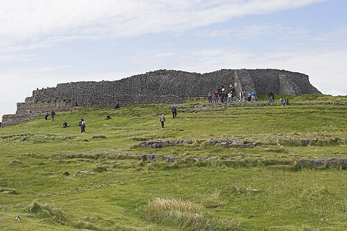 Dún AonghasaNature reserve · 48 yd
 Not locatedStructure · 71 yd
 Kilmurvey BeachBeach / strand · 328 yd
 TemplenaneeveChurch · 957 yd
 IndicatedChurch · 1401 yd
 Castle (in ruins)Castle, unclassified · 1.6 mi
 ÁrainnIsland · 1.6 mi
 An CharcairMountain / peak · 2.0 mi
 Seal Colony LookoutViewpoint · 2.4 mi
 An tOileán ThiarIslet · 3.5 mi
 Trá na mBuailte (Beach of the Booly)Beach / strand · 4.0 mi